
 Update: 01-03-2025


Place of the lighthouse
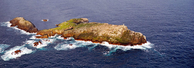
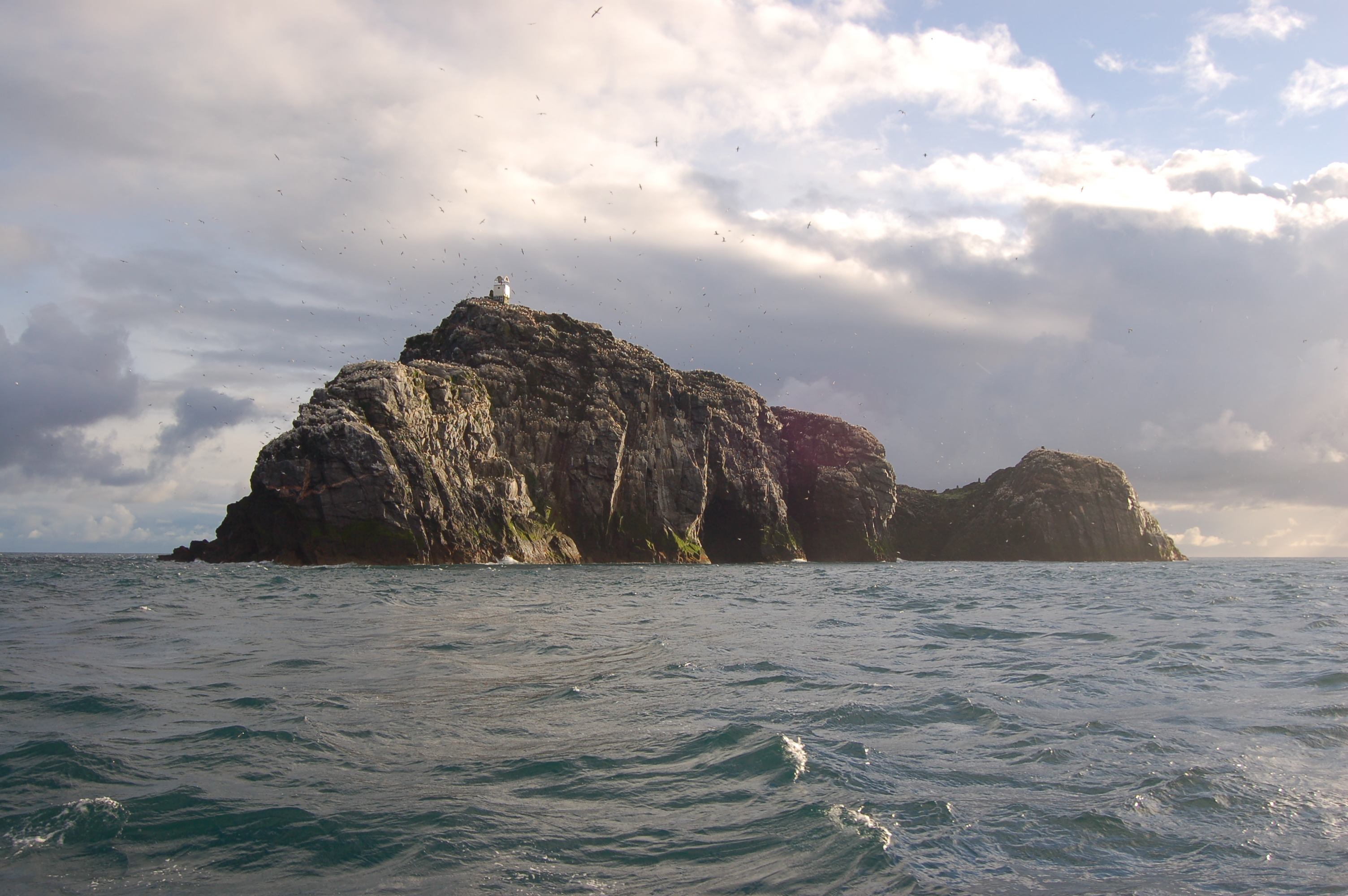
The Sula Sgeir lighthouse lies on the island Sula Sgeir a small uninhabited Scottish islet in the North Atlantic, 18 kilometres (9,5 NM) west of North Rona. One of the most remote islands of the British Isles, it lies approximately 74 km (40 NM) north of island Lewis and is best known for its population of gannets. It has a narrow elongated shape running north-northeast to south-southwest, and is approximately 900 meters long by typically 100 meter wide (apart from a central headland projecting a further 100 meter on the easterly side).
A ruined stone bothy called Taigh Beannaichte (Blessed House) can be found on the east headland Sgeir an Teampaill. The automated lighthouse on the south end at Sròn na Lice is regularly damaged by the huge waves which break over the island during rough North Atlantic storms. Despite this, the island has diverse flora.
The modern name is from the Old Norse súla, "gannet" and sker, "skerry". In the 16th century Dean Munro referred to the island as "Suilskeray". Macculloch's 1819 Description refers to "Sulisker", an Anglicised spelling that is still occasionally used. There is Suleskjer, a skerry in Utsira, Norway which has a name with a similar origin; there is also a Sule Skerryin Orkney.
The island is made of hard gneiss rock, the summit of a submarine mountain. Erosion causes the bedrock to sheer into long flat pieces. The sea has created a series of interconnected sea caves and tunnels throughout the southern part of the island. During big Atlantic storms, waves break right over the top of Sula Sgeir.History of the Lighthouse
In 1981 it was likely that a recommended deepwater route (possibly incorporating channel separation) would be established immediately to the west of the Hebrides. The recommended route was relatively near the coast which was low lying and featureless and led to the provision of navigation lights some of which were not established until 1997.
Butt of Lewis, Flannan Isles and Barra Head already existed. Possible additional sites were Gallan Head, Haskeir Island (1997), Griminish Point, Ard and Runair and Monach Isles (re-established 1997 and upgraded 2008). With the eventual introduction of the new west coast tanker route in the early 1980s from Sullom Voe oil terminal in Shetland, it was necessary to provide a major new light on North Rona with the complimentary light on Sula Sgeir.
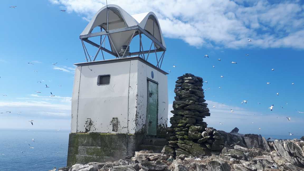
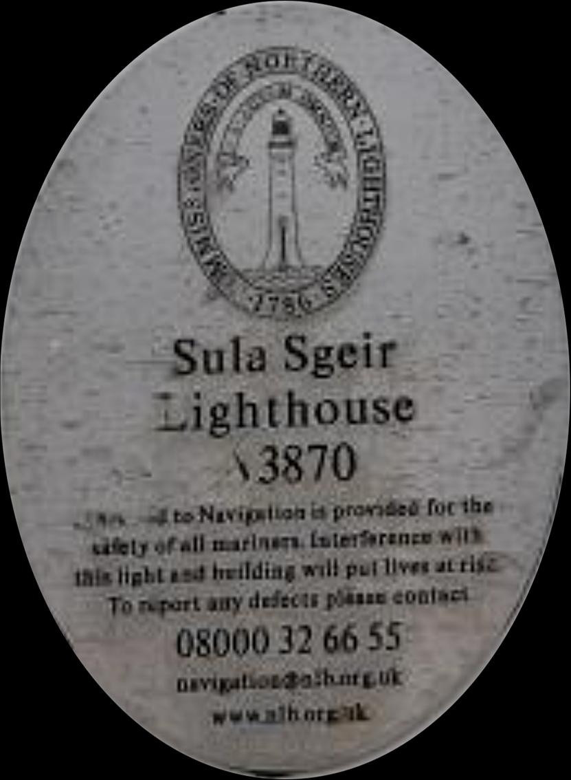
North Rona was designated as a 24 NM (now 22 NM) light to cover full area including Sula Sgeir which has a range of 12 NM (now 11 NM). Consideration was also given to using two 18 mile gas powered lights, one on North Rona and one on Sula Sgeir. However due to the difficult nature of Sula Sgeir, the simpler solution was chosen with an air de-polarised battery being used to power the light with an annual battery change out.Fauna
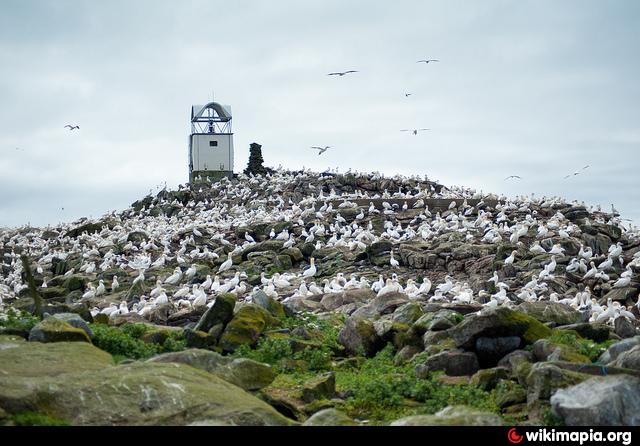
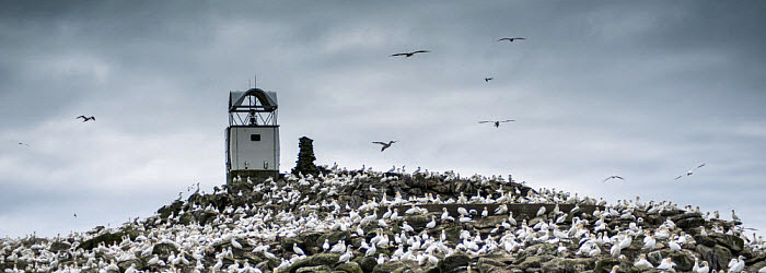
There are some 5,000 breeding pairs of gannets on Sula Sgeir, which they share with other bird species such as black-legged kittiwakes, common guillemots, puffins, northern fulmars and in the summers of 2005 to 2007 a Black-browed Albatross was resident in the gannet colony.
Together with North Rona, Sula Sgeir was formerly a national nature reserve because of its importance for birdlife and grey seal breeding. It remains a protected area for nature and is a Site of Special Scientific Interest and a Special Protection Area.
History
Saint Brianhuil or Brenhilda, the sister of St Ronan of Iona and North Rona, is supposed to have lived on Sula Sgeir as a recluse. She was found dead in a bothy with a cormorant's nest in her ribcage.
Sula Sgeir has a special place in the seafaring history of the men of the Ness district on the island of Lewis. Dean Munro visited the Hebrides in 1549 and his is one of the earliest accounts written about the Western Isles. His description of Sula Sgeir mentions that the men of Ness sailed in their small craft to "fetche hame thair boatful of dry wild fowls with wild fowl fedderi".How long before 1549 the Nessmen sailed to Sula Sgeir each year to collect the young gannets for food and feathers is not known, but it may be assumed that it was a tradition for centuries. That tradition is still carried on today.
The flesh of the young gannet or guga is regarded as a delicacy in Ness today though, for others, it is an acquired taste. It was a popular meat in earlier times in Scotland. In the sixteenth century it was served at the tables of Scots kings and was a favourite with the wealthy as a ’whet’ or appetizer before main meals. In the autumn of each year, a group of 10 Nessmen set sail for Sula Sgeir to kill a maximum of 2,000 young birds.
They set up residence for about two weeks in stone bothys. Working in pairs, the men take the fledglings from their nests with poles, catching them around the neck with a rope noose, then killing the birds with a blow to the head. They bring home their catch to meet an eager crowd of customers. The demand is often so great that the birds have to be rationed out to ensure that each person does not go without a taste of guga. In 2009, a single guga fetched £16.[16] 1953 saw the last journey under sail for the guga hunt, thereafter a fishing trawler was used, although it was still a five-hour trip.
The Sula Sgeir hunt, which would otherwise be illegal under the Wildlife and Countryside Act 1981, receives an annual licence from the government, which allows it to continue. Scottish Natural Heritage, which is now responsible for granting the licence, states that the hunt is sustainable, although it has been criticised by animal welfare groups. The Scottish SPCA describes it as "barbaric and inhumane" and believes it causes unnecessary suffering to the birds, with many taking several blows to be killed.
Sula Sgeir, with North Rona, historically formed part of the Barvas estate on Lewis, but a community buy-out of the estate from the Duckworth family in 2016 did not include the two islands, which would apparently have increased the purchase price by £80,000.