Southerness
Southerness lighthouse

Timeline of Lighthouses in Scotland

Vlag NLB
Commissioners' Flag of the NLB
In Salutem Omnium
For the Safety of All
Vlag NLB
Ensign of the NLB

Lighthouse Map Nightview Map
Light Legenda
- Standard
+ Radar Beacon
+ AIS
+ Radar Beacon/AIS
- Discontinued

Timeline of Lights
From 1750 to 1849 From 1850 to 1899 From 1900 to Today
The Lighthouses
[from the:]
East Coast North Coast Southwest Coast West Coast Inner Hebrides Outer Hebrides Orkney Islands Shetland Islands Isle of Man
NLB Stevensons Technics Useful Links
Accountability
Update: 01-04-2025
Compiled by:
@ Bob Schrage
Timeline of the construction of Scottish lighthouses
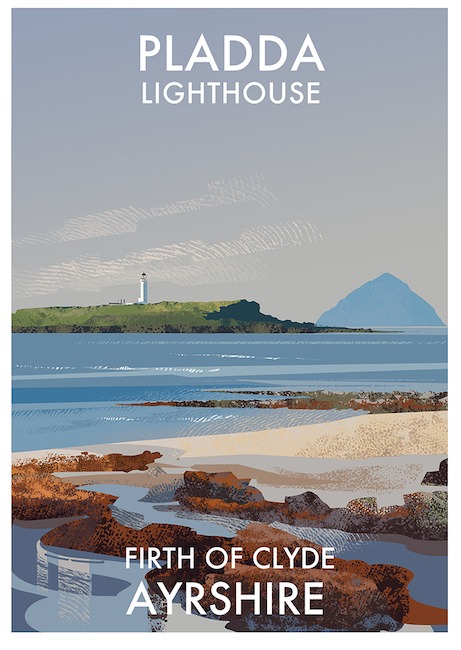
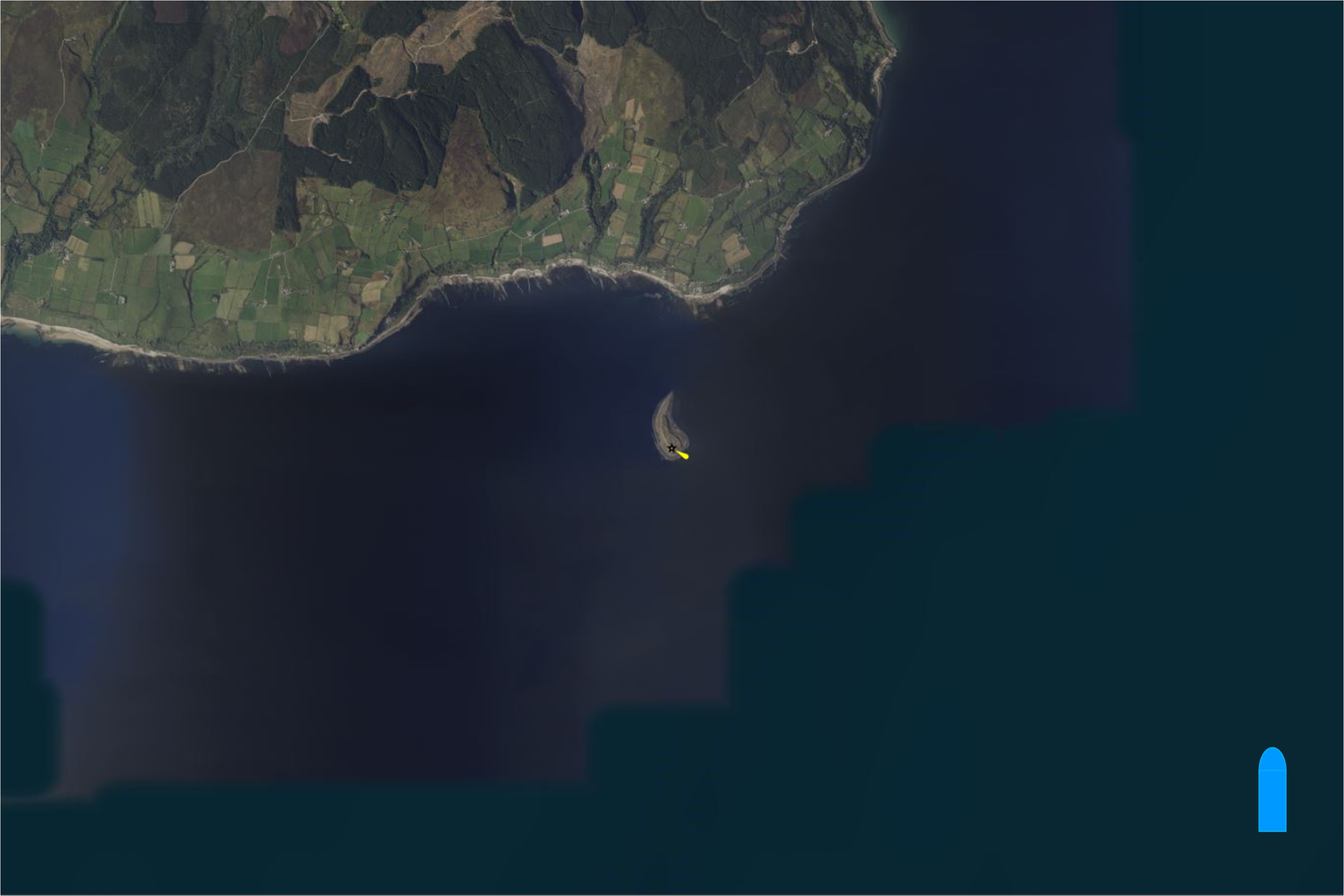
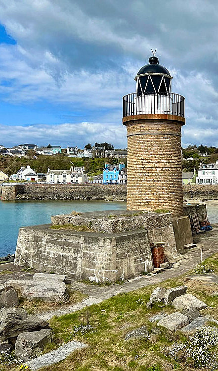
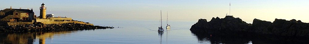
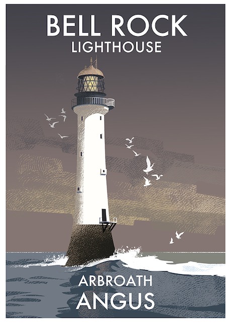
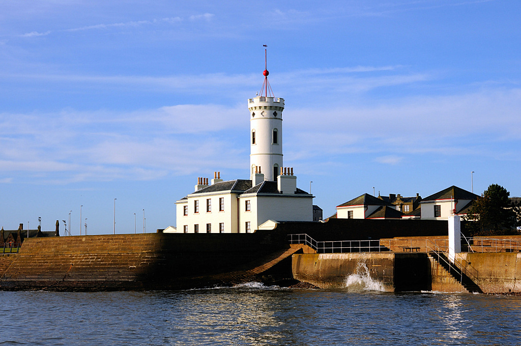
This page shows the timeline of the development and construction of lighthouses in Scotland between 1750 and 1849. During this period 34 major lighthouses were built along the coast of Scotland, including the Orkney and Shetland Islands and the Isle of Man (Manx).
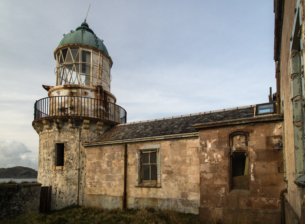
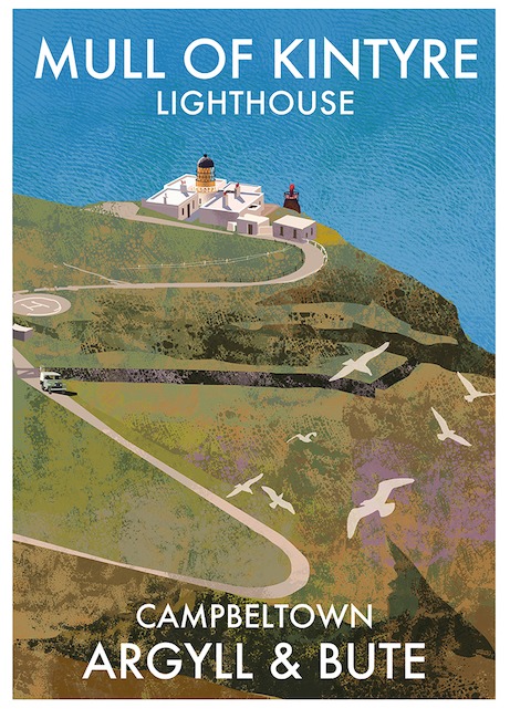
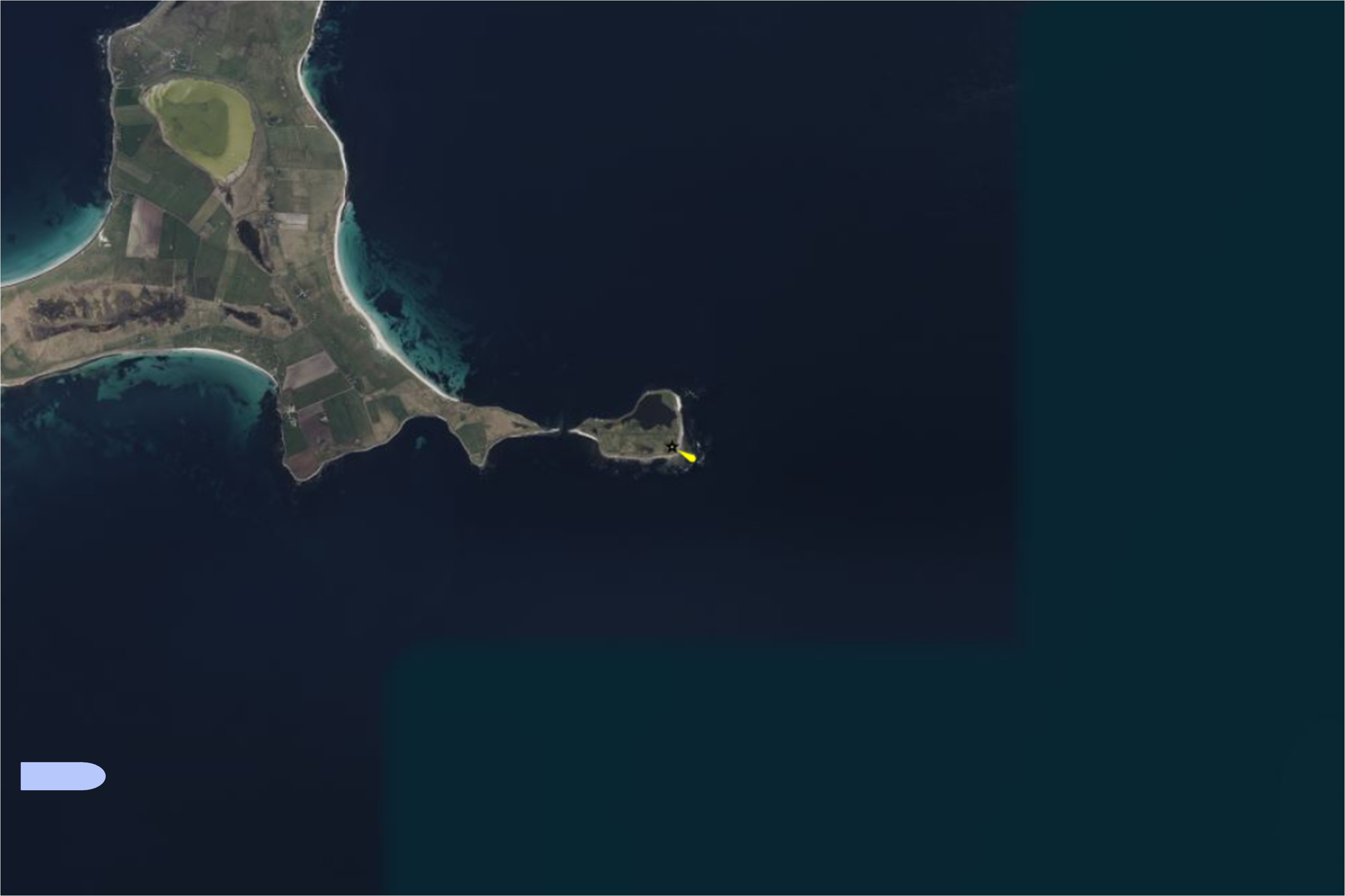
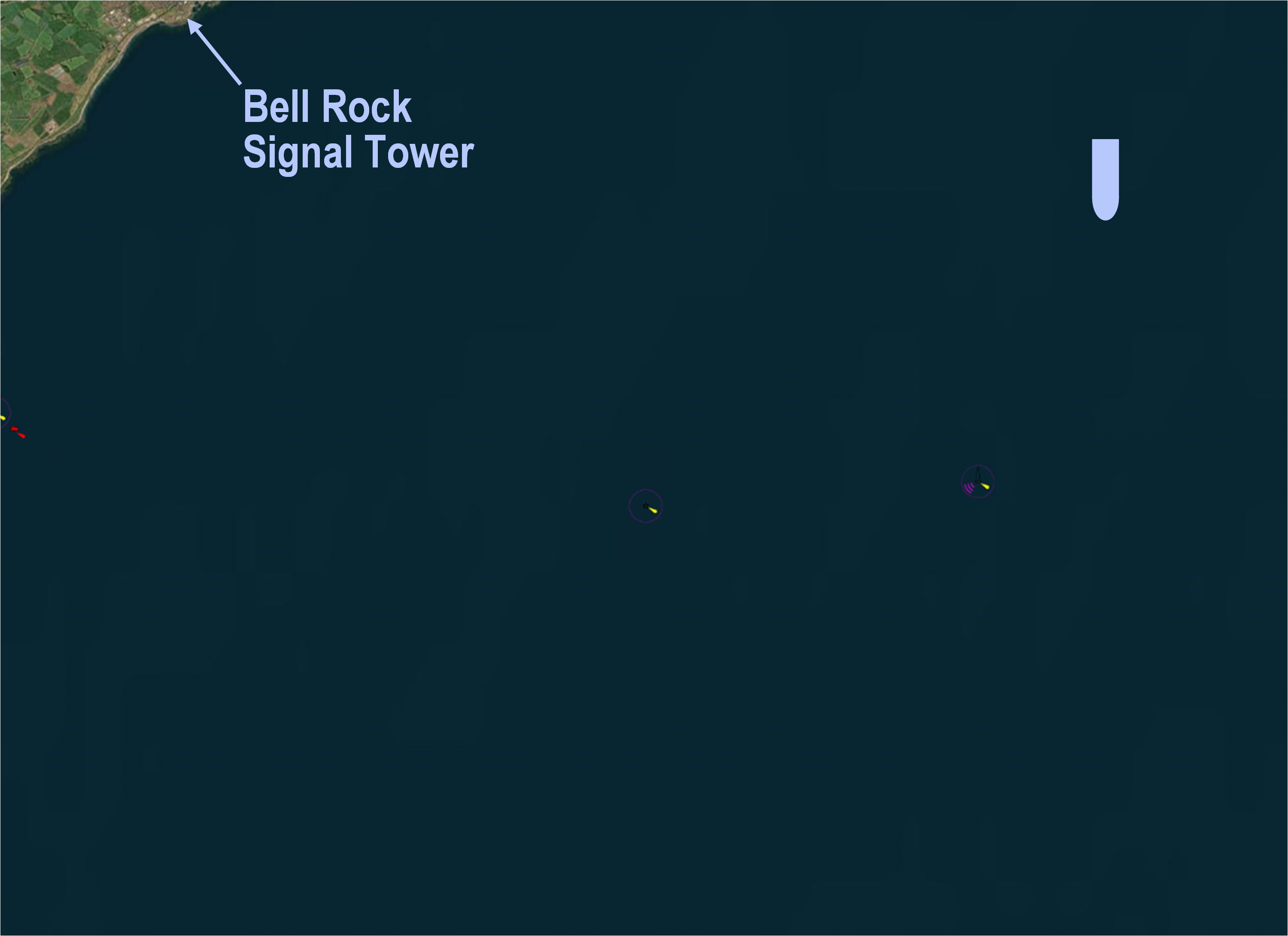
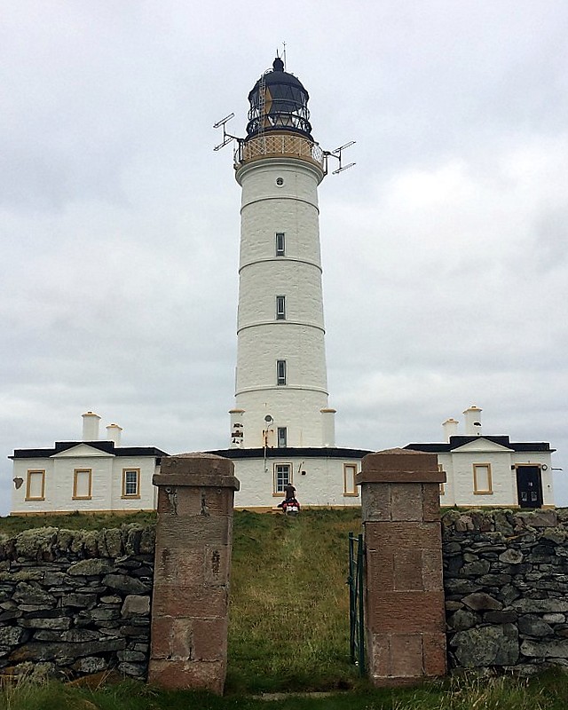
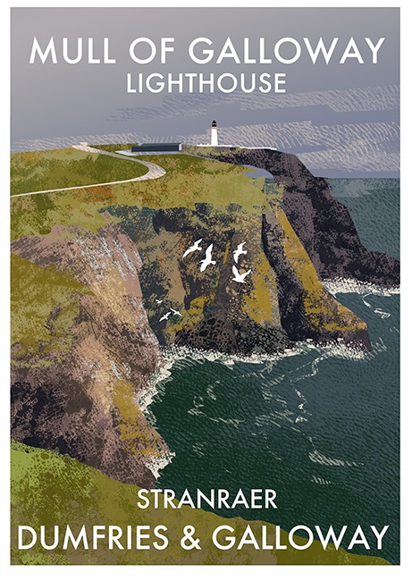
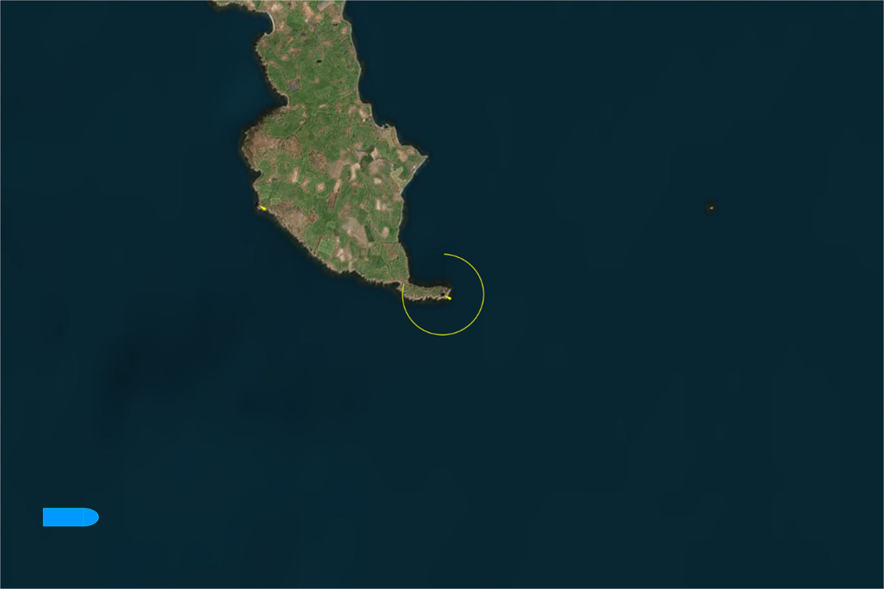
This page can be used in two ways. If the blue bars are selected per period, [ 9 lighthouses designed and built between ....... ] a preview list is shown of the lighthouses designed and built in that period.The second method is to select a specific lighthouse from the names listed under the blue bars. In the top frame a preview of this specific lighthouse is shown. In this preview you can click further to the extended description of this lighthouse. (You can also click on the various images.) More explanation of the light characters of a lighthouse can be found on my Light Characters web page.
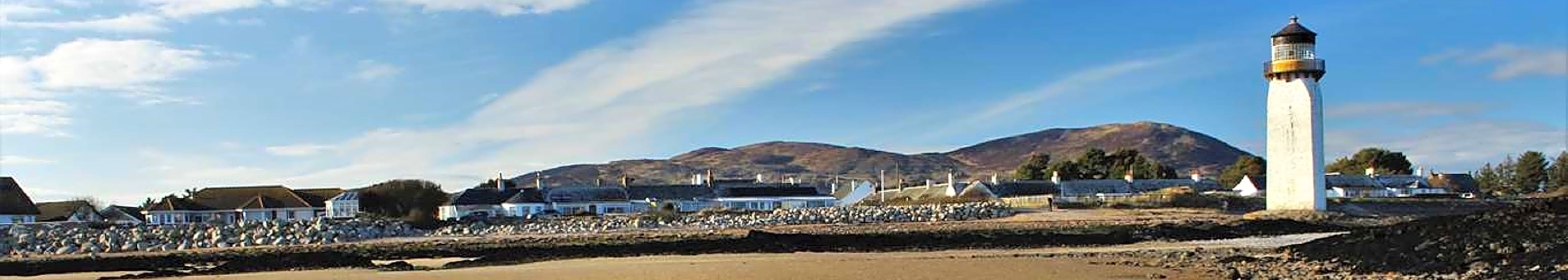
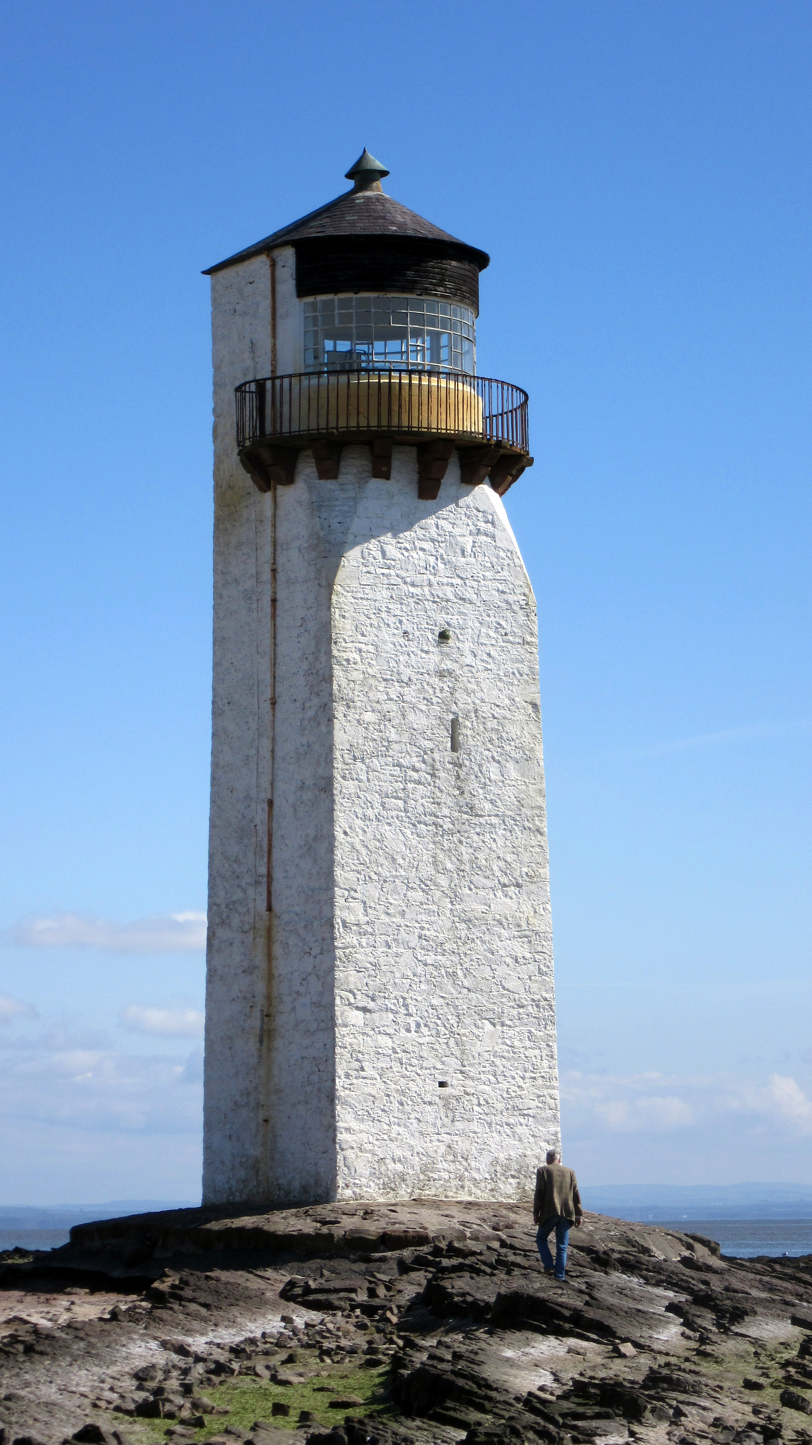
YEAR - AXXXX - Name of the lighthouse - Region (click here to see the complete webpage of this specific lighthouse.)

PART I
Lighthouse
Poster

(click to see the poster)
PART II
Engineers(s):

Pos.(Lat,Lon):
Light Character:
Light period:
Sector:
PART III
(Expl.) Thomas Smith (1752-1815)
(Expl.) 55°43.222' N, 004°58.034' W
(Expl.) Fl W 6s 11m 6M
(Expl.) Fl. 0.5s - ec. 5.5s.
(Expl.) Visible 334°-193°
PART IV
Banner Lighthouse Picture

(click to see a larger picture)
PART V
Seamap with working Lichtbeam

By clicking this map you get a bigger map


9 Lighthouses enginered and built between 1750 and 1799 [list]


1757 - A4346 - Little Cumbrea - Southwest Coast
Engineers(s):


Position (Lat,Lon):
Light Character:
Light period:
Sector:
Thomas Smith (1752-1815)


55°43.222' N, 004°58.034' W
Fl W 6s 11m 6M
Fl. 0.5s - ec. 5.5s.
Visible 334°-193°

☰ Click on image to close

1787 - A3332 - Kinnaird Head - East Coast
Engineers(s):


Position (Lat, Lon):
Light Character:
Light period:
Sector:
Thomas Smith (1752-1815)


57°41.862' N, 002°00.237' W
Fl W 5s 25m 22M
Fl. 0.2s - ec. 4.8s.
Visible 092°-297°

☰ Click on image to close

1788 - A4272 - Mull of Kintyre - Southwest Coast
Engineers(s):


Position (Lat, Lon):
Light Character:
Light period:
Sector:
Thomas Smith (1752-1815)


55°18.614' N, 005°48.202' W
Fl(2) W 20s 91m 18M
Fl. 0.4s - ec. 1.5s, Fl. 0.4s - ec 17.7s.
Visible 347°-178°.

☰ Click on image to close

1789 - A3722 - North Ronaldsay - Orkney Island
Engineers(s):
New Tower (1854):

Position (Lat, Lon):
Light Character:
Light period:
Sector:
Thomas Smith (1752-1815)
David Lilie Stevenson (1815-1886)

59°23.381' N, 02°22.882' W
Fl W 10s 43m 24M
Fl. 0.3s - ec. 9.7s
-.-

☰ Click on image to close

1789 - A3990 - Eilean Glas - Outer Hebrides
Engineers(s):
New Tower (1854):

Position (Lat, Lon):
Light Character:
Light period:
Sector:
Thomas Smith (1752-1815)
Robert Stevenson (1772-1850)

57°51.414' N, 006°38.522' W
Fl(2) WRG 9s 13m 11-9M
Fl. 0.4s - ec.1.6s, Fl. 0.4s - ec.6.6s.
-.-

☰ Click on image to close

1790 - A4326 - Pladda - Southwest Coast
Engineers(s):


Position (Lat, Lon):
Light Character:
Light period:
Sector:
Thomas Smith (1752-1815)


55°25'29.8" N 5°07'06.5" W
Fl(3) W 30s 40m 17M
2x Fl. 0.7s - ec. 3.1s, Fl. 0.7s - ec. 21.7s
-.-

☰ Click on image to close

1790 - AXXXX - Portpatrick - Southwest Coast
Engineers(s):


Position (Lat, Lon):
Light Character:
Light period:
Sector:
Thomas Smith (1752-1815)


54°50.433' N, 005°07.056' W
Discontinued
-.-
-.-

☰ Click on image to close

1794 - A3562 - Pentland Skerries - Nort Coast
Engineers(s):


Position (Lat, Lon):
Light Character:
Light period:
Sector:
Thomas Smith (1752-1815)
Robert Stevenson (1772-1850)

58°41.412' N, 002°55.479' W
Fl(3) W 30s 52m 23M
2x Fl. 0.4s - ec.5.6s; Fl. 0.4s - ec. 17.6s
-.-

☰ Click on image to close

1797 - A4404 - Cloch Point - Southwest Coast
Engineers(s):


Position (Lat, Lon):
Light Character:
Light period:
Sector:
Thomas Smith (1752-1815)
Robert Stevenson (1772-1850)

55° 56.540´ N, 004° 52.724´ W
Fl W 3s 23m 8M
Fl. 0.6s - ec. 2.4s.
-.-

☰ Click on image to close


2 Lighthouses enginered and built between 1800 and 1809 [list]


1804 - A2912 - Inchkeith - East Coast
Engineers(s):


Position (Lat, Lon):
Light Character:
Light period:
Sector:
Thomas Smith (1752-1815)
Robert Stevenson (1772 - 1850)

56°02.013' N, 003°08.173' W
Fl W 15s 67m 14M
Fl. 0.4s - ec. 14.6s
-.-

☰ Click on image to close

1806 - A3718 - Start Point - Orkeny Island
Engineers(s):


Position (Lat, Lon):
Light Character:
Light period:
Sector:
Thomas Smith (1752-1815)
Robert Stevenson (1772 - 1850)

59°16.644' N, 02°22.557' W
Fl(2) W 20s 25m 19M
Fl. 0.2s - ec. 3.8s, Fl. 0.2s - ec. 15,8s.
-.-

☰ Click on image to close


6 Lighthouses enginered and built between 1810 and 1819 [list]


1811 - A3108 - Bell Rock - East Coast>
Engineers(s):


Position (Lat, Lon):
Light Character:
Light period:
Sector:
Robert Stevenson (1772 - 1850)


59°16.644' N, 02°22.557' W
Fl(2) W 20s 25m 19M
Fl. 0.2s - ec. 3.8s, Fl. 0.2s - ec. 15,8s.
-.-

☰ Click on image to close

1812 - AXXXX - Southerness - Southwest Coast
Engineers(s):


Position (Lat, Lon):
Light Character:
Light period:
Sector:
Robert Stevenson (1772 - 1850)


54°52.369' N, 003°35.700' W
Discontinued
-.-
-.-

☰ Click on image to close

1812 - A4362 - Toward Point - Southwest Coast
Engineers(s):


Position (Lat, Lon):
Light Character:
Light period:
Sector:
Robert Stevenson (1772 - 1850)


55°51.724' N, 004°58.783' W
Fl W 10s 21m 22M
Fl. 0.2s - ec. 9.8s.
-.-

☰ Click on image to close

1816 - A3090 - Isle of May - East Coast
Engineers(s):


Position (Lat, Lon):
Light Character:
Light period:
Sector:
Robert Stevenson (1772 - 1850)
Alan Stevenson (1807 - 1865)

56°11.139' N, 002°33.457' W
Fl(2) W 15s 73m 18M
Fl. 0.3s - ec. 1.6s, Fl. 0.3s - 12.8s.
-.-

☰ Click on image to close

1817 - A4604 - Corsewall - Southwest Coast
Engineers(s):


Position (Lat, Lon):
Light Character:
Light period:
Sector:
Robert Stevenson (1772 - 1850)


55°00.429' N, 005°09.564' W
Fl(5) W 30s 34m 22M
4x Fl. 0.2s - ec. 3.5s, Fl. 0.2s - ec. 15.0s.
Visible 027°-257°.

☰ Click on image to close

1818 - A4720 - Point of Ayre - Isle of Man (Manx)
Engineers(s):


Position (Lat, Lon):
Light Character:
Light period:
Sector:
Robert Stevenson (1772 - 1850)


54°24.940' N, 004°22.090' W
Fl(4) W 20s 32m 19M
3x Fl. 0.2s - ec. 2.3s; Fl. 0.2s - ec. 12.3s.
-.-

☰ Click on image to close


4 Lighthouses enginered and built between 1820 and 1829 [list]


1821 - A3766 - Sumburgh Head - Shetland Islands
Engineers(s):


Position (Lat, Lon):
Light Character:
Light period:
Sector:
Robert Stevenson (1772 - 1850)


59°51.243' N, 001°16.476' W
Fl(3) W 30s 91m 23M
2x Fl. 0.4s - ec. 2.1s, Fl. 0.4s - 24.6s.
-.-

☰ Click on image to close

1825 - A4256 - Rhinns of Islay - Inner Hebrides
Engineers(s):


Position (Lat, Lon):
Light Character:
Light period:
Sector:
Robert Stevenson (1772 - 1850)


55°40.384' N, 006°30.790' W
Fl W 5s 46m 18M
Fl. 0.2s - ec. 4.8s)
Visible 256°-184°.

☰ Click on image to close

1827 - A3280 - Buchan Ness - East Coast
Engineers(s):


Position (Lat, Lon):
Light Character:
Light period:
Sector:
Robert Stevenson (1772 - 1850)


57°28.227' N, 001°46.474' W
Fl W 5s 40m 18M
Fl. 0.3s - ec. 4.7s.
none (shuttered at the rear)

☰ Click on image to close

1828 - A3880 - Cape Wrath - North Coast
Engineers(s):


Position (Lat, Lon):
Light Character:
Light period:
Sector:
Robert Stevenson (1772 - 1850)


58°37.534' N, 004°59.930' W
Fl(4) W 30s 122m 21M
3x Fl. 0.2s - ec. 3.6s, Fl. 0.2s - ec. 18.4s.
-.-

☰ Click on image to close


6 Lighthouses enginered and built between 1830 and 1839 [list]


1830 - A3506 - Tarbat Ness - East Coast
Engineers(s):


Position (Lat, Lon):
Light Character:
Light period:
Sector:
Robert Stevenson (1772 - 1850)


57°51.906' N, 003°46.590' W
Fl(4) W 30s 53m 18M
3x Fl. 0.7s - ec. 2.1s, Fl. 0.7s - ec. 20.9s.
-.-

☰ Click on image to close

1830 - A4619 - Mull of Galloway - Southwest Coast
Engineers(s):


Position (Lat, Lon):
Light Character:
Light period:
Sector:
Robert Stevenson (1772 - 1850)


54°38.101' N, 004°51.411' W
Fl W 20s 99m 18M
Fl. 0.5s - ec. 19.5s.
Visible 182°-105°.

☰ Click on image to close

1831 - A3574 - Dunnet Head - North Coast
Engineers(s):


Position (Lat, Lon):
Light Character:
Light period:
Sector:
Robert Stevenson (1772 - 1850)


58°40.280' N, 003°22.585' W
Fl(4) W 30s 105m 23Mb
3x Fl. 0.7s - ec. 2.0s, Fl. 0.7s - ec. 21.2s
-.-

☰ Click on image to close

1833 - A3246 - Girdle Ness - East Coast
Engineers(s):

Position (Lat, Lon):
Light Character:
Light period:
Sector:
Robert Stevenson (1772 - 1850)

57°08.339' N, 002°02.916' W
Fl(2) W 20s 56m 22M
Fl. 0.5s - ec. 2.0s, Fl. 0.5s - ec. 17.0s
Obscured by Greg Ness when bearing more than about 020°-025°.

☰ Click on image to close

1833 - A4020 - Barra Head - Outer Hebrides
Engineers(s):


Position (Lat, Lon):
Light Character:
Light period:
Sector:
Robert Stevenson (1772 - 1850)


56°47.131' N, 007°39.215' W
Fl W 15s 208m 18M
Fl. 0.3s - ec. 14.7s.
Obscured by islands NE.

☰ Click on image to close

1833 - A4170 - Lismore - Inner Hebrides
Engineers(s):


Position (Lat, Lon):
Light Character:
Light period:
Sector:
Robert Stevenson (1772 - 1850)
Alan Stevenson (1807 - 1865)

56°27.333' N, 005°36.449' W
Fl W 10s 31m 17M
Fl. 0.2s - ec. 9.8s
Visible 237°-208°.

☰ Click on image to close


8 Lighthouses enginered and built between 1840 and 1849 [list]


1843 - A4634 and 4633.99 (Beacon) - Little Ross - Southwest Coast
Engineers(s):


Position (Lat, Lon):
Light Character:
Light period:
Sector:
Alan Stevenson (1807 - 1865)


54°45.946' N, 004°05.093' W
Fl W 5s 50m 12M
Fl. 0.5s - ec. 4.5s.
Obscured in Wigton Bay S. of 103°.

☰ Click on image to close

1844 - A4096 - Skerryvore - Inner Hebrides
Engineers(s):


Position (Lat, Lon):
Light Character:
Light period:
Sector:
Alan Stevenson (1807 - 1865)


56°19.366' N, 007°06.882' W
Fl W 10s 46m 23M
Fl. 0.4s - ec. 9.6s.
-.-

☰ Click on image to close

1846 - A3440 - Chanonry Point - East Coast
Engineers(s):


Position (Lat, Lon):
Light Character:
Light period:
Sector:
Alan Stevenson (1807 - 1865)


57°34.441' N, 004°05.567' W
Oc W 6s 12m 15M
Lit. 4.5s - ec. 1.5s.

☰ Click on image to close

1846 - A3414 - Covesea Skerry - East Coast
Engineers(s):


Position (Lat, Lon):
Light Character:
Light period:
Sector:
Alan Stevenson (1807 - 1865)


57°43.449' N, 003°20.312' W
Discontinued
Fl(4) WR 20s.
-.-

☰ Click on image to close

1846 - A3490(ex) - Cromarty - East Coast
Engineers(s):


Position (Lat, Lon):
Light Character:
Light period:
Sector:
Alan Stevenson (1807 - 1865)


57°40.984' N, 004°02.187' W
Discontinued
was Oc. WR 10s.
-.-

☰ Click on image to close

1847 - A4592 - Cairn Point - Loch Rayn - Southwest Coast
Engineers(s):


Position (Lat, Lon):
Light Character:
Light period:
Sector:
Alan Stevenson (1807 - 1865)


54°58.468' N, 005°01.850' W
Fl(2) R 10s 14m 12M
Fl. 0.1s - ec 2.4s, Fl. 0.1s - ec. 7.4s.
-.-

☰ Click on image to close

1849 - A3544 - Noss Head - East Coast
Engineers(s):


Position (Lat, Lon):
Light Character:
Light period:
Sector:
Alan Stevenson (1807 - 1865)


58°28.744' N, 003°03.046' W
Fl WR 20s 53m 18M
Fl. 0.5s - ec 19.5s.
R. 073°-191°, W.-045°.

☰ Click on image to close

1849 - A4082 - Ardnamurchan - West Coast
Engineers(s):


Position (Lat, Lon):
Light Character:
Light period:
Sector:
Alan Stevenson (1807 - 1865)


56°43.625' N, 006°13.558' W
Fl(2) W 20s 55m 18M
Fl. 0.5s - ec 2.0s, Fl. 0.5 - ec 17.0s.
Visible 002°-217°.

☰ Click on image to close


1757 - A4346 - Little Cumbrea - Southwest Coast
Engineers(s):


Position (Lat,Lon):
Light Character:
Light period:
Sector:
Thomas Smith (1752-1815)


55°43.222' N, 004°58.034' W
Fl W 6s 11m 6M
Fl. 0.5s - ec. 5.5s.
Visible 334°-193°


☰ Click on image to close
1787 - A3332 - Kinnaird Head - East Coast
Engineers(s):


Position (Lat, Lon):
Light Character:
Light period:
Sector:
Thomas Smith (1752-1815)


57°41.862' N, 002°00.237' W
Fl W 5s 25m 22M
Fl. 0.2s - ec. 4.8s.
Visible 092°-297°


☰ Click on image to close
1788 - A4272 - Mull of Kintyre - Southwest Coast
Engineers(s):


Position (Lat, Lon):
Light Character:
Light period:
Sector:
Thomas Smith (1752-1815)


55°18.614' N, 005°48.202' W
Fl(2) W 20s 91m 18M
Fl. 0.4s - ec. 1.5s, Fl. 0.4s - ec 17.7s.
Visible 347°-178°.


☰ Click on image to close
1789 - A3722 - North Ronaldsay - Orkney Island
Engineers(s):
New Tower (1854):

Position (Lat, Lon):
Light Character:
Light period:
Sector:
Thomas Smith (1752-1815)
David Lilie Stevenson (1815-1886)

59°23.381' N, 02°22.882' W
Fl W 10s 43m 24M
Fl. 0.3s - ec. 9.7s
-.-


☰ Click on image to close
1789 - A3990 - Eilean Glas - Outer Hebrides
Engineers(s):
New Tower (1854):

Position (Lat, Lon):
Light Character:
Light period:
Sector:
Thomas Smith (1752-1815)
Robert Stevenson (1772-1850)

57°51.414' N, 006°38.522' W
Fl(2) WRG 9s 13m 11-9M
Fl. 0.4s - ec.1.6s, Fl. 0.4s - ec.6.6s.
-.-


☰ Click on image to close
1790 - A4326 - Pladda - Southwest Coast
Engineers(s):


Position (Lat, Lon):
Light Character:
Light period:
Sector:
Thomas Smith (1752-1815)


55°25'29.8" N 5°07'06.5" W
Fl(3) W 30s 40m 17M
2x Fl. 0.7s - ec. 3.1s, Fl. 0.7s - ec. 21.7s
-.-


☰ Click on image to close
1790 - AXXXX - Portpatrick - Southwest Coast
Engineers(s):


Position (Lat, Lon):
Light Character:
Light period:
Sector:
Thomas Smith (1752-1815)


54°50.433' N, 005°07.056' W
Discontinued
-.-
-.-


☰ Click on image to close
1794 - A3562 - Pentland Skerries - Nort Coast
Engineers(s):


Position (Lat, Lon):
Light Character:
Light period:
Sector:
Thomas Smith (1752-1815)
Robert Stevenson (1772-1850)

58°41.412' N, 002°55.479' W
Fl(3) W 30s 52m 23M
2x Fl. 0.4s - ec.5.6s; Fl. 0.4s - ec. 17.6s
-.-


☰ Click on image to close
1797 - A4404 - Cloch Point - Southwest Coast
Engineers(s):


Position (Lat, Lon):
Light Character:
Light period:
Sector:
Thomas Smith (1752-1815)
Robert Stevenson (1772-1850)

55° 56.540´ N, 004° 52.724´ W
Fl W 3s 23m 8M
Fl. 0.6s - ec. 2.4s.
-.-


☰ Click on image to close
1804 - A2912 - Inchkeith - East Coast
Engineers(s):


Position (Lat, Lon):
Light Character:
Light period:
Sector:
Thomas Smith (1752-1815)
Robert Stevenson (1772 - 1850)

56°02.013' N, 003°08.173' W
Fl W 15s 67m 14M
Fl. 0.4s - ec. 14.6s
-.-


☰ Click on image to close
1806 - A3718 - Start Point - Orkeny Island
Engineers(s):


Position (Lat, Lon):
Light Character:
Light period:
Sector:
Thomas Smith (1752-1815)
Robert Stevenson (1772 - 1850)

59°16.644' N, 02°22.557' W
Fl(2) W 20s 25m 19M
Fl. 0.2s - ec. 3.8s, Fl. 0.2s - ec. 15,8s.
-.-


☰ Click on image to close
1811 - A3108 - Bell Rock - East Coast>
Engineers(s):


Position (Lat, Lon):
Light Character:
Light period:
Sector:
Robert Stevenson (1772 - 1850)


59°16.644' N, 02°22.557' W
Fl(2) W 20s 25m 19M
Fl. 0.2s - ec. 3.8s, Fl. 0.2s - ec. 15,8s.
-.-


☰ Click on image to close
1812 - A4362 - Toward Point - Southwest Coast
Engineers(s):


Position (Lat, Lon):
Light Character:
Light period:
Sector:
Robert Stevenson (1772 - 1850)


55°51.724' N, 004°58.783' W
Fl W 10s 21m 22M
Fl. 0.2s - ec. 9.8s.
-.-


☰ Click on image to close
1817 - A4604 - Corsewall - Southwest Coast
Engineers(s):


Position (Lat, Lon):
Light Character:
Light period:
Sector:
Robert Stevenson (1772 - 1850)


55°00.429' N, 005°09.564' W
Fl(5) W 30s 34m 22M
4x Fl. 0.2s - ec. 3.5s, Fl. 0.2s - ec. 15.0s.
Visible 027°-257°.


☰ Click on image to close
1812 - AXXXX - Southerness - Southwest Coast
Engineers(s):


Position (Lat, Lon):
Light Character:
Light period:
Sector:
Robert Stevenson (1772 - 1850)


54°52.369' N, 003°35.700' W
Discontinued
-.-
-.-


☰ Click on image to close
1816 - A3090 - Isle of May - East Coast
Engineers(s):


Position (Lat, Lon):
Light Character:
Light period:
Sector:
Robert Stevenson (1772 - 1850)
Alan Stevenson (1807 - 1865)

56°11.139' N, 002°33.457' W
Fl(2) W 15s 73m 18M
Fl. 0.3s - ec. 1.6s, Fl. 0.3s - 12.8s.
-.-

☰ Click on image to close
1818 - A4720 - Point of Ayre - Isle of Man (Manx)
Engineers(s):


Position (Lat, Lon):
Light Character:
Light period:
Sector:
Robert Stevenson (1772 - 1850)


54°24.940' N, 004°22.090' W
Fl(4) W 20s 32m 19M
3x Fl. 0.2s - ec. 2.3s; Fl. 0.2s - ec. 12.3s.
-.-


☰ Click on image to close
1821 - A3766 - Sumburgh Head - Shetland Islands
Engineers(s):


Position (Lat, Lon):
Light Character:
Light period:
Sector:
Robert Stevenson (1772 - 1850)


59°51.243' N, 001°16.476' W
Fl(3) W 30s 91m 23M
2x Fl. 0.4s - ec. 2.1s, Fl. 0.4s - 24.6s.
-.-


☰ Click on image to close
1825 - A4256 - Rhinns of Islay - Inner Hebrides
Engineers(s):


Position (Lat, Lon):
Light Character:
Light period:
Sector:
Robert Stevenson (1772 - 1850)


55°40.384' N, 006°30.790' W
Fl W 5s 46m 18M
Fl. 0.2s - ec. 4.8s)
Visible 256°-184°.


☰ Click on image to close
1827 - A3280 - Buchan Ness - East Coast
Engineers(s):


Position (Lat, Lon):
Light Character:
Light period:
Sector:
Robert Stevenson (1772 - 1850)


57°28.227' N, 001°46.474' W
Fl W 5s 40m 18M
Fl. 0.3s - ec. 4.7s.
none (shuttered at the rear)


☰ Click on image to close
1828 - A3880 - Cape Wrath - North Coast
Engineers(s):


Position (Lat, Lon):
Light Character:
Light period:
Sector:
Robert Stevenson (1772 - 1850)


58°37.534' N, 004°59.930' W
Fl(4) W 30s 122m 21M
3x Fl. 0.2s - ec. 3.6s, Fl. 0.2s - ec. 18.4s.
-.-


☰ Click on image to close
1830 - A3506 - Tarbat Ness - East Coast
Engineers(s):


Position (Lat, Lon):
Light Character:
Light period:
Sector:
Robert Stevenson (1772 - 1850)


57°51.906' N, 003°46.590' W
Fl(4) W 30s 53m 18M
3x Fl. 0.7s - ec. 2.1s, Fl. 0.7s - ec. 20.9s.
-.-


☰ Click on image to close
1830 - A4619 - Mull of Galloway - Southwest Coast
Engineers(s):


Position (Lat, Lon):
Light Character:
Light period:
Sector:
Robert Stevenson (1772 - 1850)


54°38.101' N, 004°51.411' W
Fl W 20s 99m 18M
Fl. 0.5s - ec. 19.5s.
Visible 182°-105°.


☰ Click on image to close
1831 - A3574 - Dunnet Head - North Coast
Engineers(s):


Position (Lat, Lon):
Light Character:
Light period:
Sector:
Robert Stevenson (1772 - 1850)


58°40.280' N, 003°22.585' W
Fl(4) W 30s 105m 23Mb
3x Fl. 0.7s - ec. 2.0s, Fl. 0.7s - ec. 21.2s
-.-


☰ Click on image to close
1833 - A3246 - Girdle Ness - East Coast
Engineers(s):

Position (Lat, Lon):
Light Character:
Light period:
Sector:
Robert Stevenson (1772 - 1850)

57°08.339' N, 002°02.916' W
Fl(2) W 20s 56m 22M
Fl. 0.5s - ec. 2.0s, Fl. 0.5s - ec. 17.0s
Obscured by Greg Ness when bearing more than about 020°-025°.


☰ Click on image to close
1833 - A4020 - Barra Head - Outer Hebrides
Engineers(s):


Position (Lat, Lon):
Light Character:
Light period:
Sector:
Robert Stevenson (1772 - 1850)


56°47.131' N, 007°39.215' W
Fl W 15s 208m 18M
Fl. 0.3s - ec. 14.7s.
Obscured by islands NE.


☰ Click on image to close
1833 - A4170 - Lismore - Inner Hebrides
Engineers(s):


Position (Lat, Lon):
Light Character:
Light period:
Sector:
Robert Stevenson (1772 - 1850)
Alan Stevenson (1807 - 1865)

56°27.333' N, 005°36.449' W
Fl W 10s 31m 17M
Fl. 0.2s - ec. 9.8s
Visible 237°-208°.


☰ Click on image to close
1844 - A4096 - Skerryvore - Inner Hebrides
Engineers(s):


Position (Lat, Lon):
Light Character:
Light period:
Sector:
Alan Stevenson (1807 - 1865)


56°19.366' N, 007°06.882' W
Fl W 10s 46m 23M
Fl. 0.4s - ec. 9.6s.
-.-


☰ Click on image to close
1846 - A3490(ex) - Cromarty - East Coast
Engineers(s):


Position (Lat, Lon):
Light Character:
Light period:
Sector:
Alan Stevenson (1807 - 1865)


57°40.984' N, 004°02.187' W
Discontinued
was Oc. WR 10s.
-.-


☰ Click on image to close
1849 - A4082 - Ardnamurchan - West Coast
Engineers(s):


Position (Lat, Lon):
Light Character:
Light period:
Sector:
Alan Stevenson (1807 - 1865)


56°43.625' N, 006°13.558' W
Fl(2) W 20s 55m 18M
Fl. 0.5s - ec 2.0s, Fl. 0.5 - ec 17.0s.
Visible 002°-217°.


☰ Click on image to close
1846 - A3440 - Chanonry Point - East Coast
Engineers(s):


Position (Lat, Lon):
Light Character:
Light period:
Sector:
Alan Stevenson (1807 - 1865)


57°34.441' N, 004°05.567' W
Oc W 6s 12m 15M
Lit. 4.5s - ec. 1.5s.


☰ Click on image to close
1847 - A4592 - Cairn Point - Loch Rayn - Southwest Coast
Engineers(s):


Position (Lat, Lon):
Light Character:
Light period:
Sector:
Alan Stevenson (1807 - 1865)


54°58.468' N, 005°01.850' W
Fl(2) R 10s 14m 12M
Fl. 0.1s - ec 2.4s, Fl. 0.1s - ec. 7.4s.
-.-


☰ Click on image to close
1849 - A3544 - Noss Head - East Coast
Engineers(s):


Position (Lat, Lon):
Light Character:
Light period:
Sector:
Alan Stevenson (1807 - 1865)


58°28.744' N, 003°03.046' W
Fl WR 20s 53m 18M
Fl. 0.5s - ec 19.5s.
R. 073°-191°, W.-045°.

☰ Click on image to close
1846 - A3414 - Covesea Skerry - East Coast
Engineers(s):


Position (Lat, Lon):
Light Character:
Light period:
Sector:
Alan Stevenson (1807 - 1865)


57°43.449' N, 003°20.312' W
Discontinued
Fl(4) WR 20s.
-.-


☰ Click on image to close
1843 - A4634 and 4633.99 (Beacon) - Little Ross - Southwest Coast
Engineers(s):


Position (Lat, Lon):
Light Character:
Light period:
Sector:
Alan Stevenson (1807 - 1865)


54°45.946' N, 004°05.093' W
Fl W 5s 50m 12M
Fl. 0.5s - ec. 4.5s.
Obscured in Wigton Bay S. of 103°.

☰ Click on image to close