12 Lighthouses built between 1900 and 1909
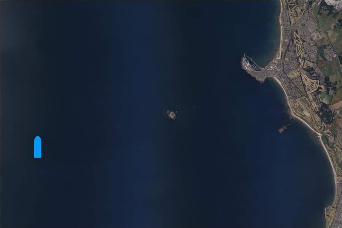
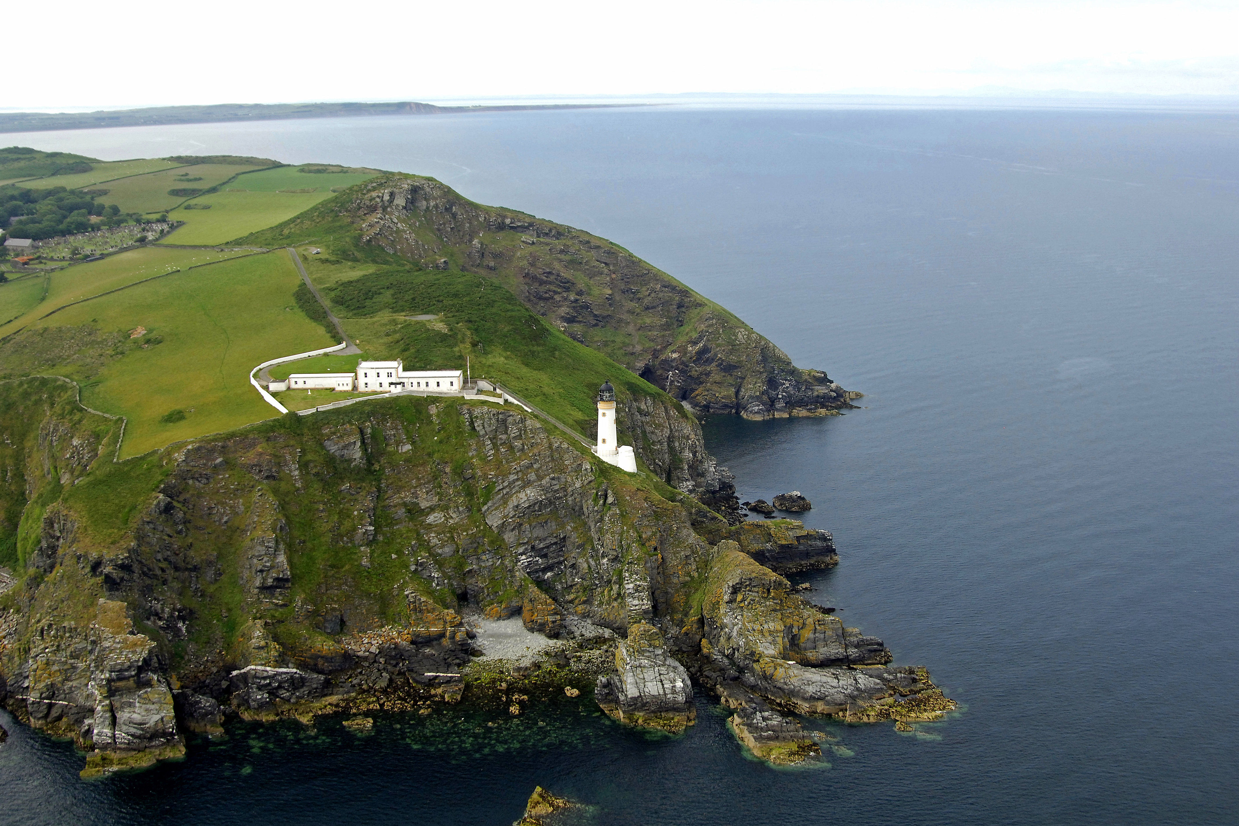
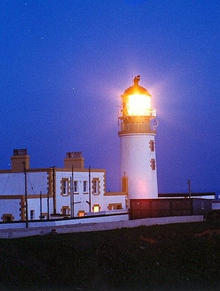
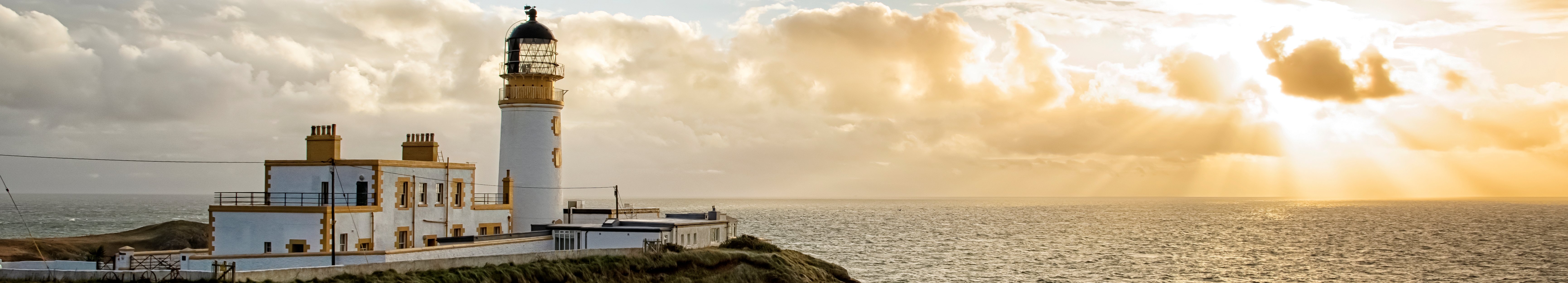
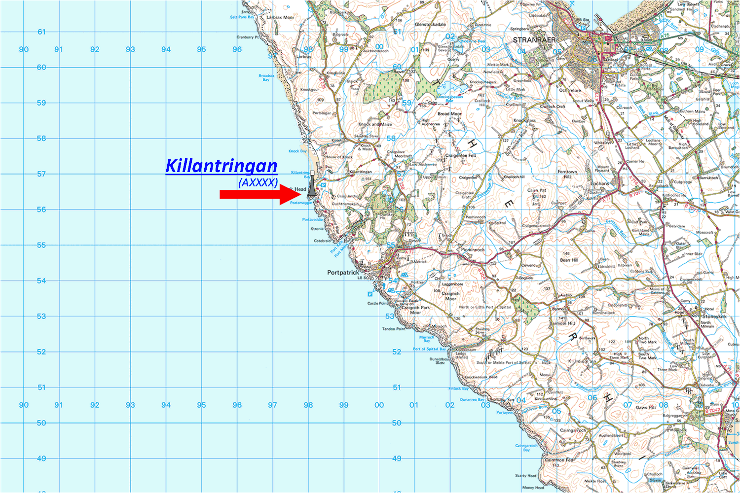
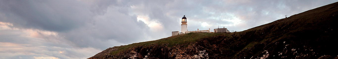
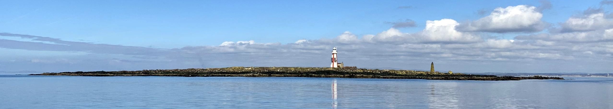
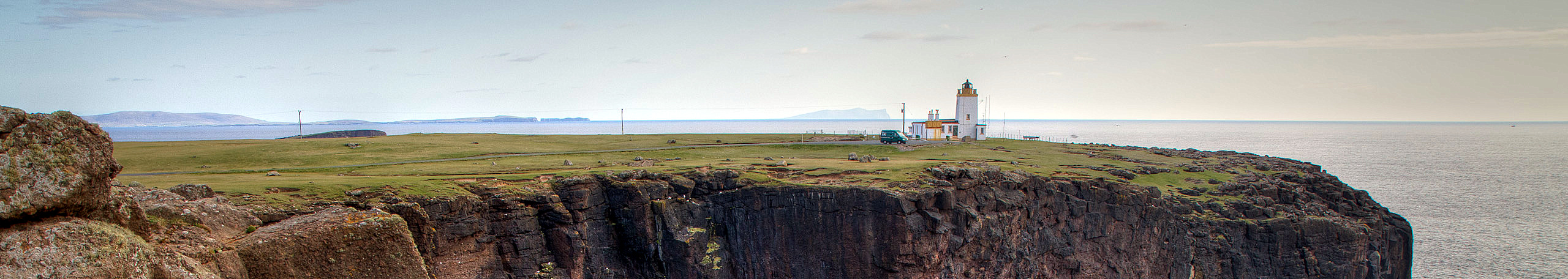
1900 - AXXXX - Killantringan - Southwest Coast
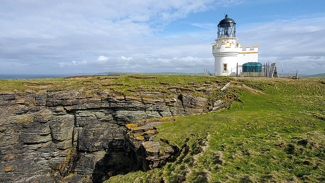
1901 - A3610 - Hoxa Head - Orkney Island
1905 - A4330 - Holy Island - Southwest Coast
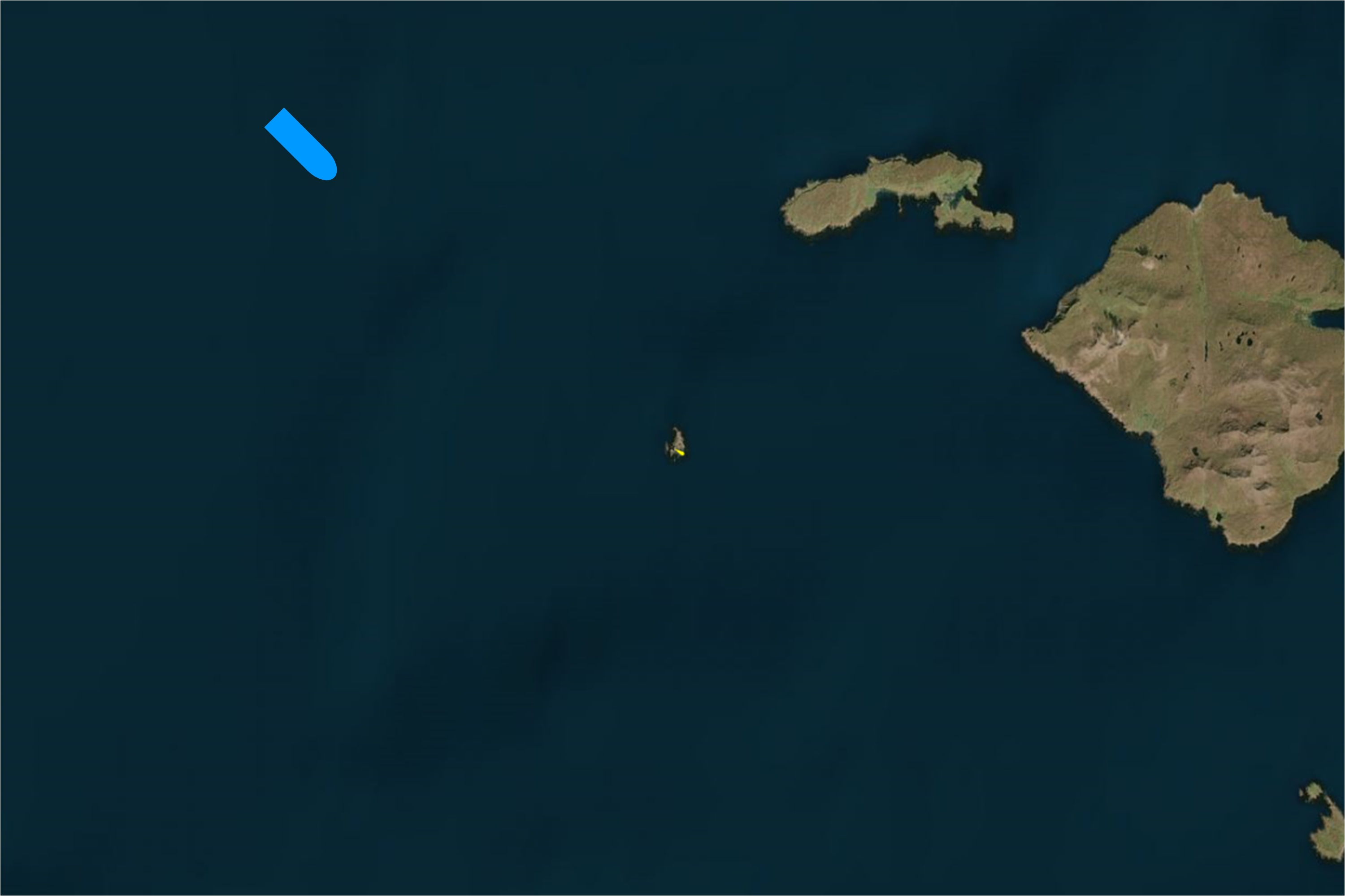
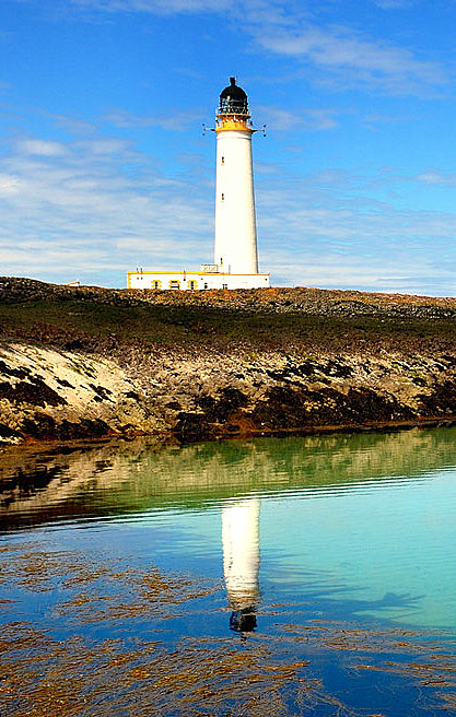
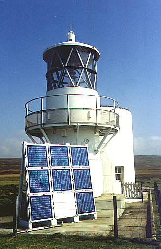
1900 - A3972 - Tiumpan Head - Outer Hebrides
1903 - A2864 - Bass Rock - East Coast
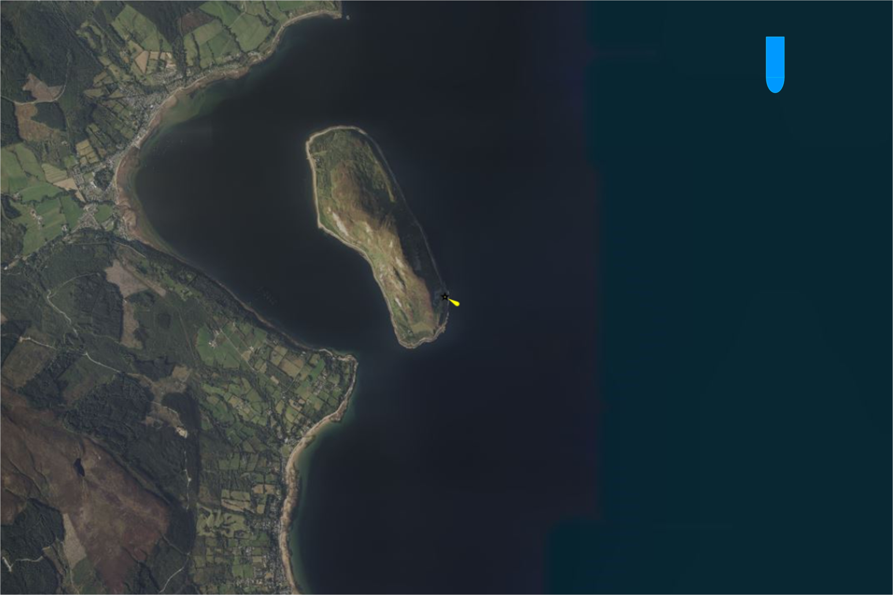
1908 - A4050 - Trodday Island - Inner Hebrides
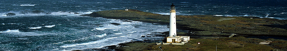
1901 - A2854(ex) - Barns Ness - East Coast
1903 - A4562 - Lady Isle - Southwest Coast
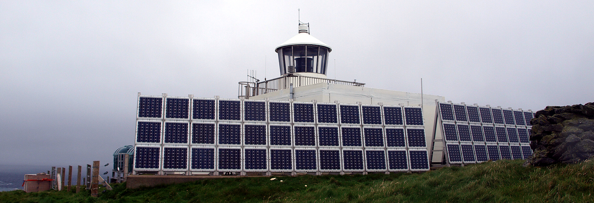
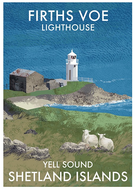
1909 - A3812 - Firths Voe - Shetlands Island
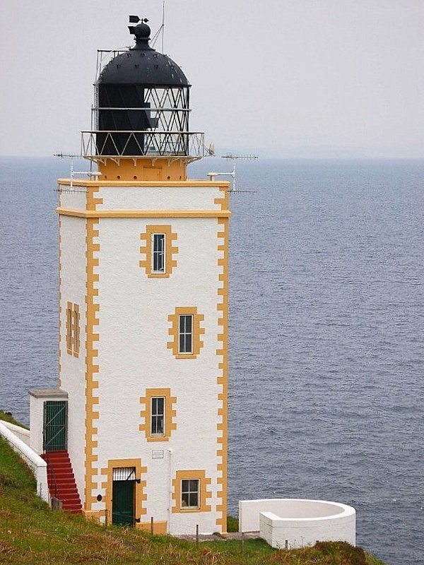
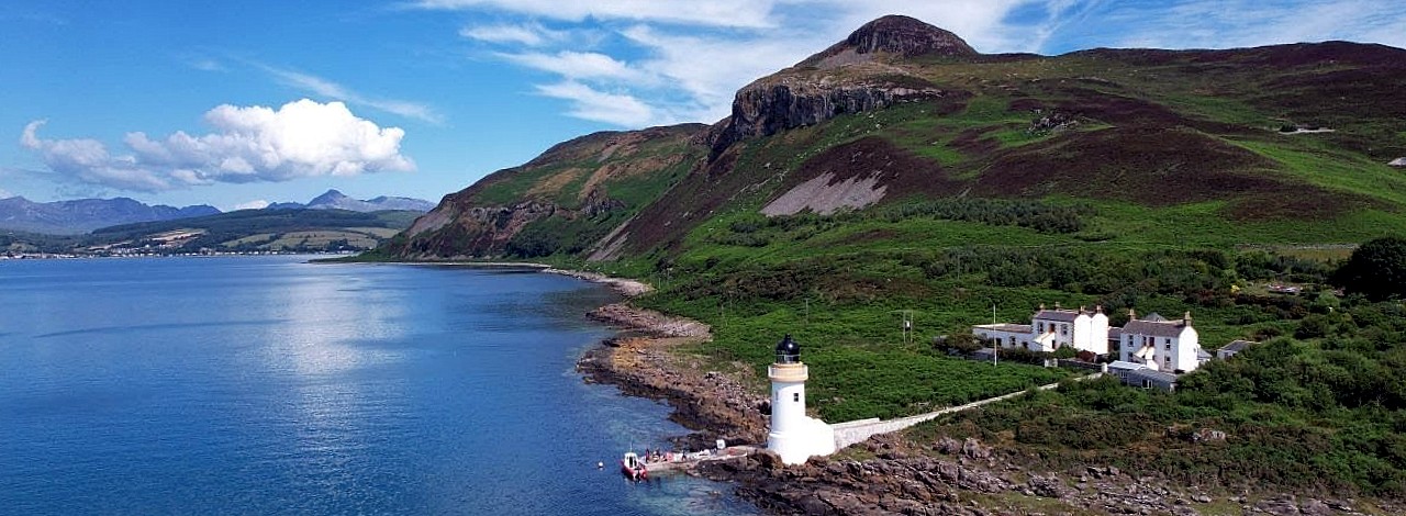
1901 - A4174 - Duart Point - Inner Hebrides
1904 - A4076 - Hyskeir (Oigh Sgeir) - Inner Hebrides
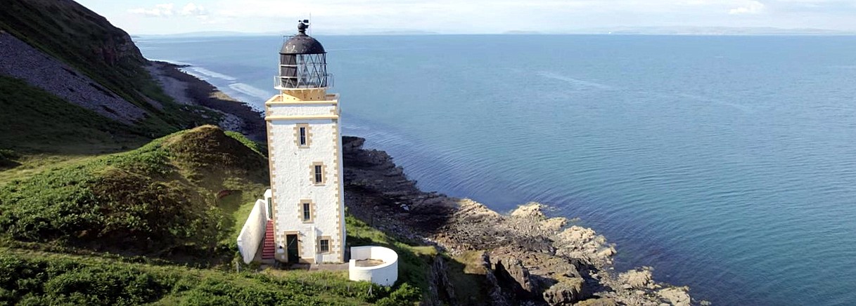
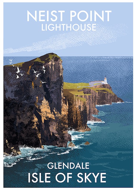
1909 - A4064 - Neist Point - Inner Hebrides
1900 - AXXXX - Killantringan - Southwest Coast
 Engineers(s):
Position (Lat, Lon):
Light Character:
Light period:
Sector:
David Alan Stevenson (1854-1938)
54°51.710' N, 005°08.818' W
Discontinued, 11 July 2007
-.-
-.-

☰ Click on image to close
1900 - A3972 - Tiumpan Head - Outer Hebrides
 Engineers(s):
Position (Lat, Lon):
Light Character:
Light period:
Sector:
David Allan Stevenson (1854-1938)
Charles Stevenson (1855-1950)
58°15.656' N, 006°08.335' W
Fl(2) W 15s 55m 18M
Fl. 0.4s - ec. 1.5s, Fl 0.4s - ec. 12.7s
-.-
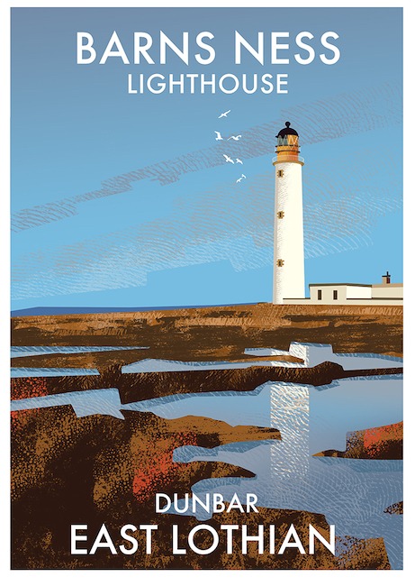
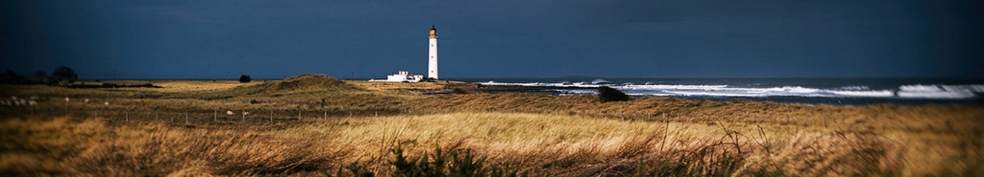
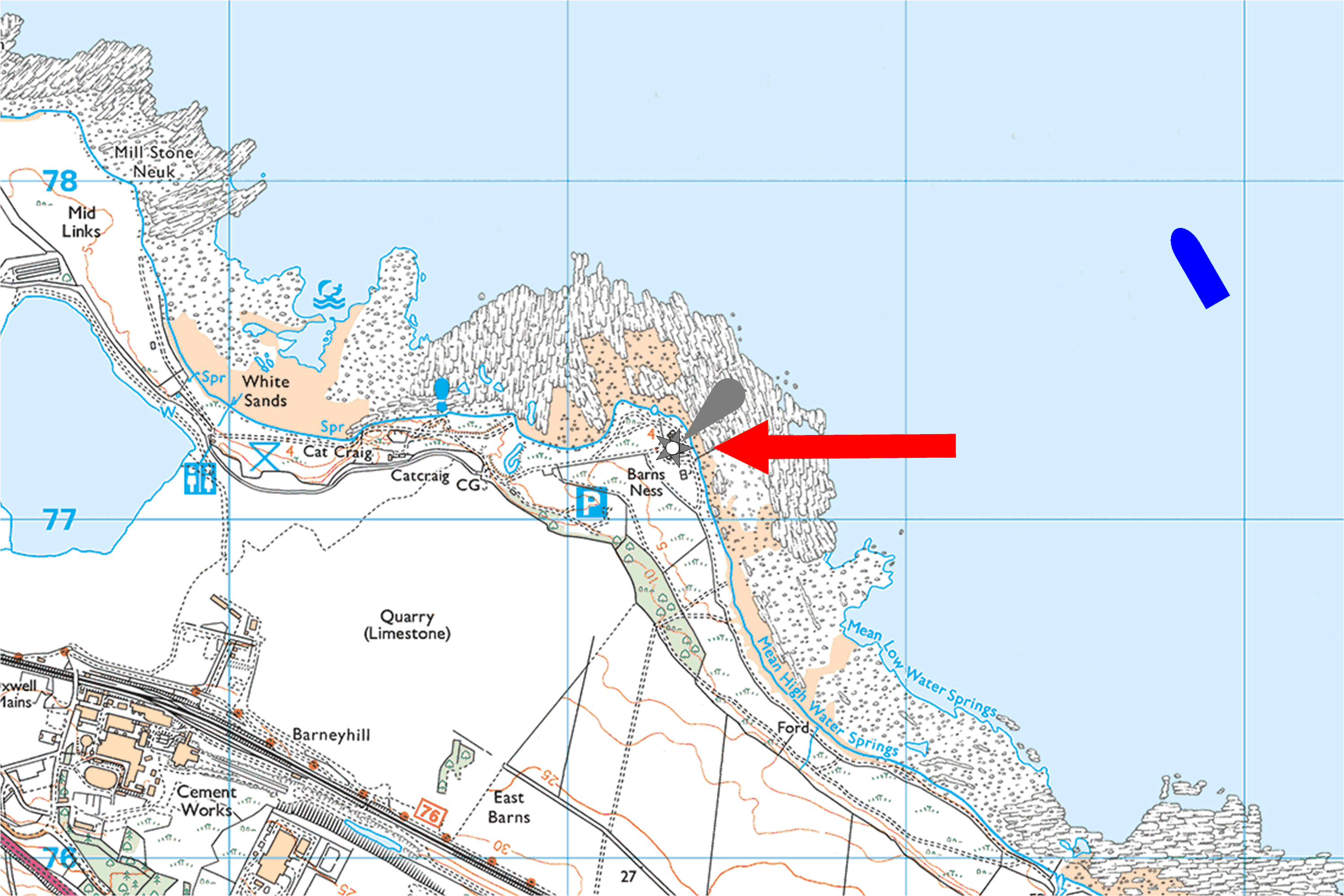
1901 - A2854(Ex) - Barns Ness - East Coast
 Engineers(s):
Position (Lat, Lon):
Light Character:
Light period:
Sector:
David Alan Stevenson (1854-1938)
Charles Stevenson (1855-1950)
55°59.237' N, 002°26.716' W
Discontinued, 11 July 2007
-.-
-.-
☰ Click on image to close
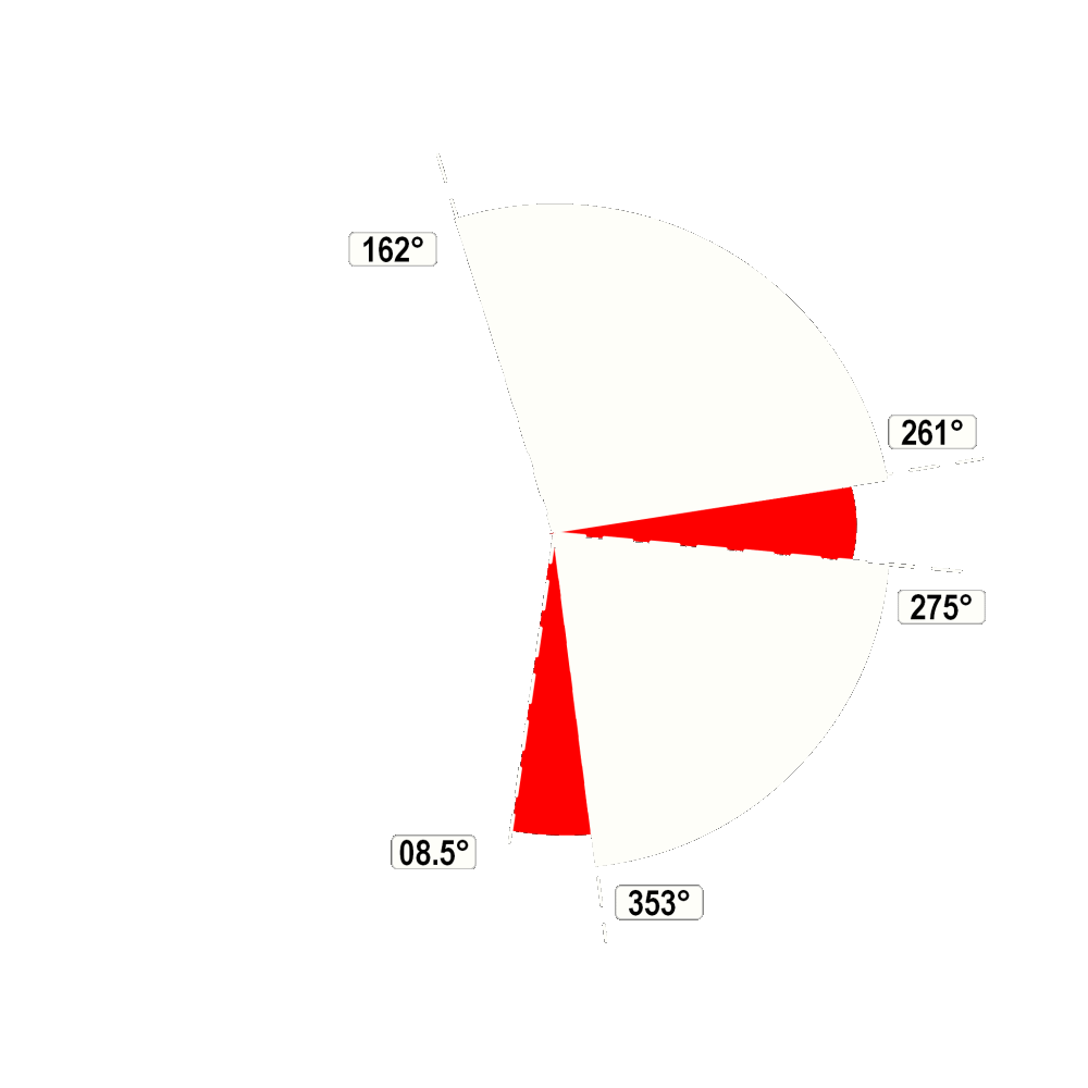
1901 - A4174 - Duart Point - Inner Hebrides
 Engineers(s):
Position (Lat, Lon):
Light Character:
Light period:
Sector:
David Allan Stevenson (1854-1938)
56°26.846' N, 005°38.764' W
Fl(3) WR 18s 30m 5-3M
2x Fl.0.5s-ec.1.5s, Fl.0.5s-ec. 13.5s
W.162°-261°, R.-275°, W.-353°, R.-08.5°


1901 - A3610 - Hoxa Head - Orkney Island
 Engineers(s):
Position (Lat, Lon):
Light Character:
Light period:
Sector:
David Allan Stevenson (1854-1938)
58°49.3' N, 003°02.1' W
Fl WR 3s 15m 9-6M
Fl. 0.3s - ec. 2.7s
W. 026°-163°, R.-201°, W.-215°.

1903 - A2864 - Bass Rock - East Coast
 Engineers(s):
Position (Lat, Lon):
Light Character:
Light period:
Sector:
David Allan Stevenson (1854-1938)
Charles Stevenson (1855-1950)
56°04.603' N, 002°38.463' W
Fl(3) W 20s 46m 10M
2x Fl 0.5s - ec. 2.0s, Fl 0.5s - ec 14.5s.
Visible 241°-107°.

1903 - A4562 - Lady Isle - Southwest Coast
 Engineers(s):
Position (Lat, Lon):
Light Character:
Light period:
Sector:
David Allan Stevenson (1854-1938)
Charles Stevenson (1855-1950)
55°31.629' N, 004°44.033' W
Fl W 2s 19m 11M
Fl 0.5s - ec. 1.5s.
-.-
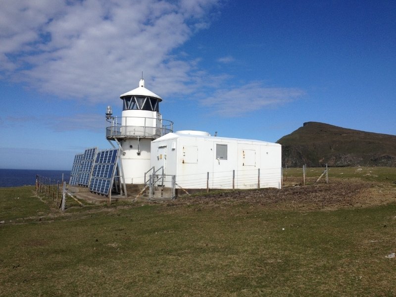
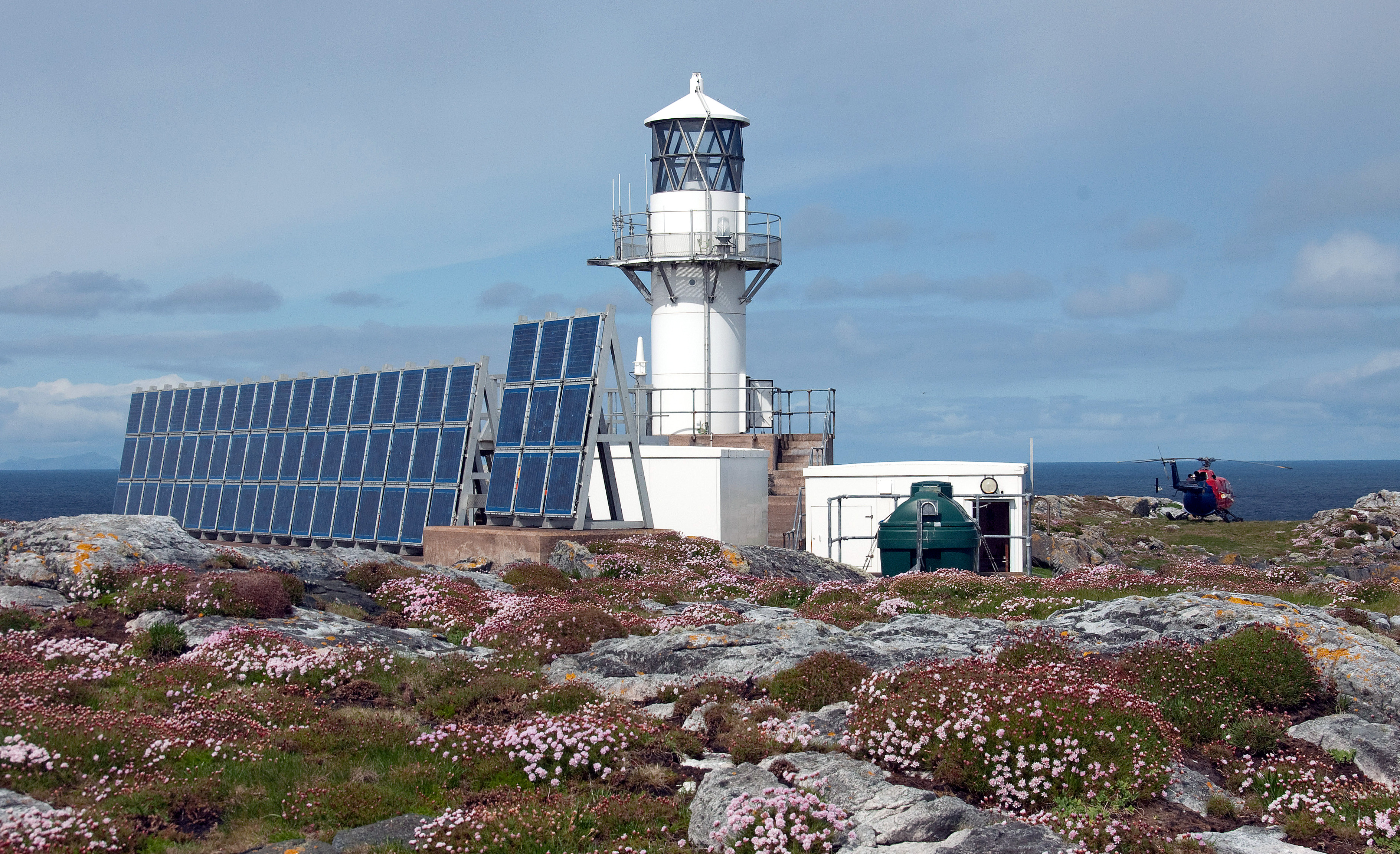
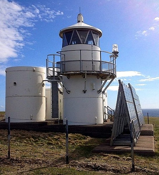
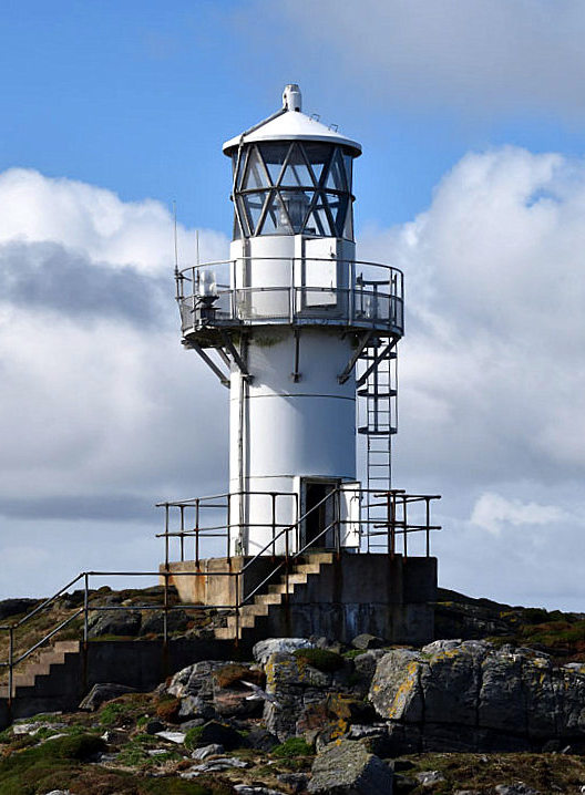
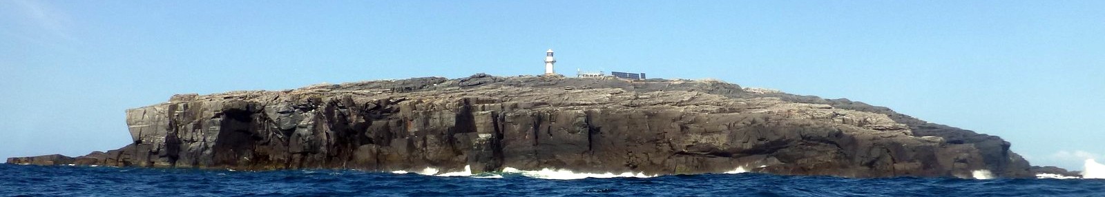
1904 - A4076 - Hyskeir (Oigh Sgeir) - Inner Hebrides
 Engineers(s):
Position (Lat, Lon):
Light Character:
Light period:
Sector:
David Allan Stevenson (1854-1938)
Charles Stevenson (1855-1950)
56°58.162' N, 006°40.815' W
Fl(3) W 30s 41m 24M
2x Fl. 0.2s - ec. 3.0s, Fl 0.2s - ec. 23.4s)
-.-
1905 - A4330 - Holy Island (Pillar Rock) - Southwest Coast>
 Engineers(s):
Position (Lat, Lon):
Light Character:
Light period:
Sector:
David Allan Stevenson (1854-1938)
Charles Stevenson (1855-1950)
55°31.042' N, 05°03.653' W>
Fl(2) W 20s 38m 18M
Fl. 0.5s - ec. 2.0s, Fl. 0.5s - ec.17.0s)
-.-
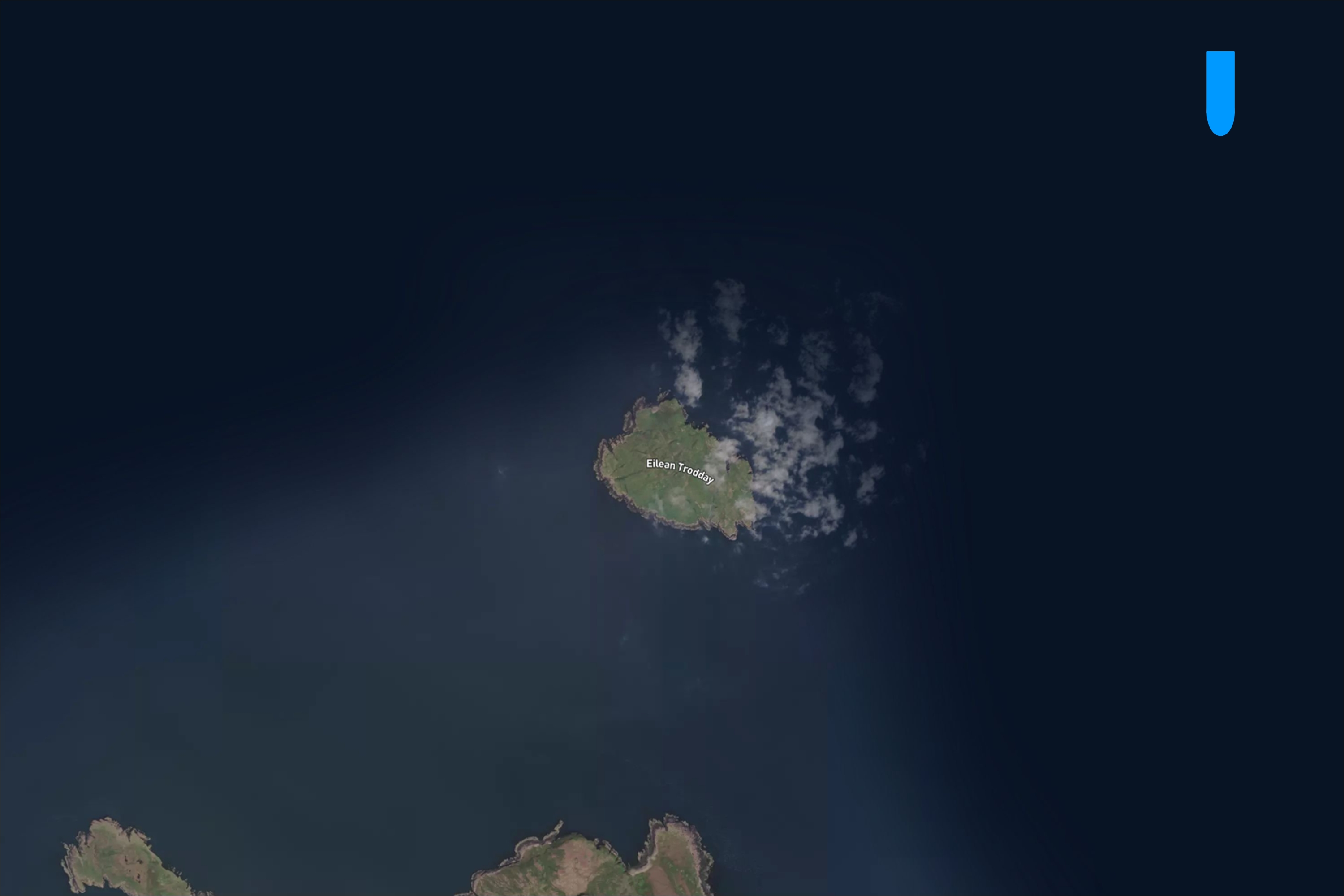
1908 - A4050 - Trodday Island - Inner Hebrides
 Engineers(s):
Position (Lat, Lon):
Light Character:
Light period:
Sector:
David Allan Stevenson (1854-1938)
Charles Stevenson (1855-1950)
57°43′37.2″ N 006°18′0″ W
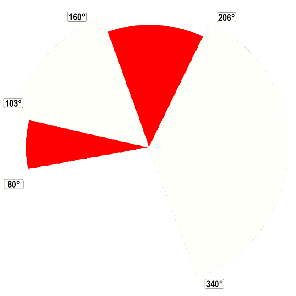
Fl(2) WRG 10s 52m 12-9M
Fl. 0.3s - ec. 1.5s, Fl. 0.3s - ec. 7.9s
W. 062°-088°, R.-130°, W.-322°, G.-062°.

1909 - A3812 - Firths Voe - Shetlands Island
 Engineers(s):
Position (Lat, Lon):
Light Character:
Light period:
Sector:
David Allan Stevenson (1854-1938)
Charles Stevenson (1855-1950)
60°27.224' N, 001°10.621' W
Oc. WRG 8s 9m 15-10M
Lit. 6.0s - ec. 2.0s.
W. 189°-194°, G.-257°, W.-261°, R.-339°, W.-066°.

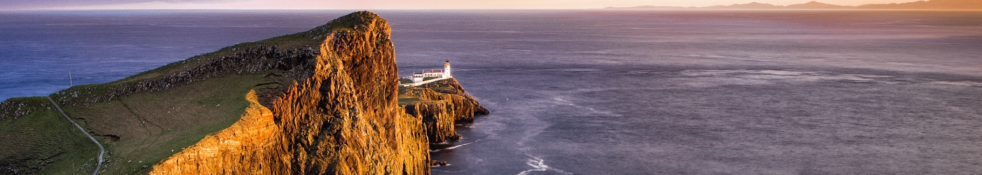
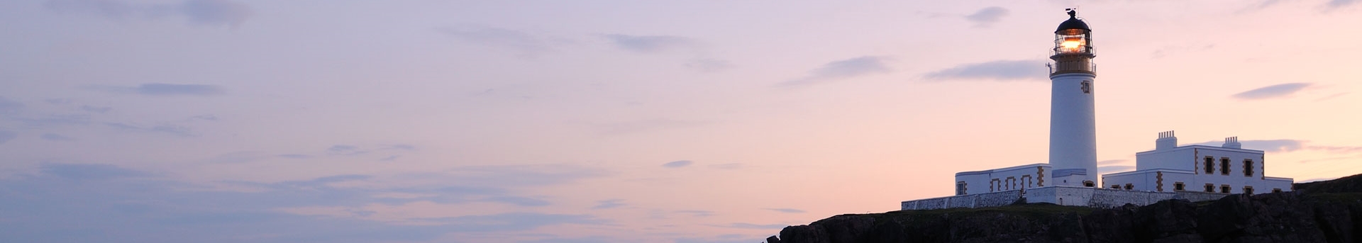
1909 - A4064 - Neist Point - Inner Hebrides
 Engineers(s):
Position (Lat, Lon):
Light Character:
Light period:
Sector:
David Allan Stevenson (1854-1938)
Charles Stevenson (1855-1950)
57°25.390' N, 006°47.310' W
Fl W 5s 43m 16M
Fl. 0.3s - ec. 4.7s
-.-
8 Lighthouses built between 1910 and 1929
1912 - A3900 - Rubha Reidh - West Coast
1916 - A3524(ex) - Clyth Ness - East Coast
1925 - A3700 - Brough of Birsay - Orkney Islands
1914 - A4786 - Maughold Head - Isle of Man (Manx)
1916 - A3060 - Elie Ness - East Coast
1929 - A3838 - Esha Ness - Shetland Island
1915 - A3676 - Copinsay - Orkney Island
1924 - A3558 - Duncansby Head - North Coast
1912 - A3900 - Rubha Reidh - West Coast
 Engineers(s):
Position (Lat, Lon):
Light Character:
Light period:
Sector:
David Allan Stevenson (1854-1938)
Charles Stevenson (1855-1950)
57°51.527' N, 005°48.713' W
Fl(4) W 15s 37m 18M
3x Fl. 0.4s - ec. 2.1s, Fl. 0.4s - ec. 7.1s
-.-
1914 - A4786 - Maughold Head - Isle of Man (Manx)
 Engineers(s):
Position (Lat, Lon):
Light Character:
Light period:
Sector:
David Allan Stevenson (1854-1938)
Charles Stevenson (1855-1950)
54°17.743' N, 04°18.564' W
Fl(3) W 30s 65m 15M
2x Fl. 0.5s - ec. 2.0s, Fl. 0.5s - ec. 24.5s.
-,-

1915 - A3676 - Copinsay - Orkney Island
 Engineers(s):
Position (Lat, Lon):
Light Character:
Light period:
Sector:
David Allan Stevenson (1854-1938)
Charles Stevenson (1855-1950)
58°53.783' N, 02°40.323' W
Fl(5) W 30s 79m 14M
4x Fl. 0.7s - ec. 2.5s, Fl. 0.7s - ec. 16.5s.

1916 - A3524(Ex) - Clyth Ness - East Coast
 Engineers(s):
Position (Lat, Lon):
Light Character:
Light period:
Sector:
David Allan Stevenson (1854-1938)
58°18.568' N, 003°12.728' W
Discontinued, 18 March, 2010
was Fl. W 30s.
-.-


☰ Click on image to close
1916 - A3060 - Elie Ness - East Coast
 Engineers(s):
Position (Lat, Lon):
Light Character:
Light period:
Sector:
David Allan Stevenson (1854-1938)
56°11.037' N, 002°48.764' W
Fl W 6s 15m 17M
Fl. 0.2s - ec. 5.8s.
-.-

1924 - A3558 - Duncansby Head - North Coast
 Engineers(s):
Position (Lat, Lon):
Light Character:
Light period:
Sector:
David Allan Stevenson (1854-1938)
Charles Stevenson (1855-1950)
58°38.636' N, 003°01.520' W
Fl W 12s 67m 21M
Fl. 0.3s - ec. 11.7s.
-.-

1925 - A3700 - Brough of Birsay - Orkney Islands
 Engineers(s):
Position (Lat, Lon):
Light Character:
Light period:
Sector:
David Allan Stevenson (1854-1938)
59°08.208' N, 03°20.350' W
Fl(3) W 25s 52m 18M
2x Fl. 0.1s - ec. 4.0s., Fl. 0.1s. - ec. 16.7s.
-.-

1929 - A3838 - Esha Ness - Shetland Islands
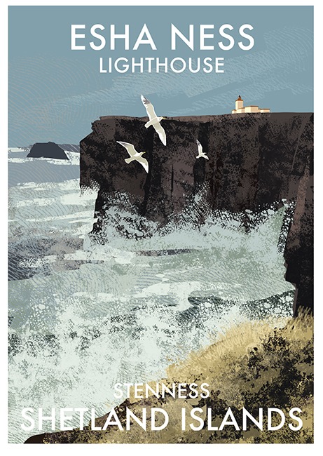 Engineers(s):
Position (Lat, Lon):
Light Character:
Light period:
Sector:
David Allan Stevenson (1854-1938)
Charles Stevenson (1855-1950)
60°29.355' N, 001°37.652' W
Fl W 12s 61m 25M
Fl. 0.4s - ec. 11.6s.
-.-
9 Lighthouses built between 1930 till Today
1937 - A3600 - Tor Ness - Orkney Island
1977 - A3817.50 - Point of Fethaland - Shetlands
1984 - A3869 - North Rona - Outer Hebride
1958 - A3590(ex) - Straty Point - North Coast
1979 - A3847 - Ve Skerries - Shetland Islands
1986 - A3860 - Foula - Shetland Islands
1975 - A3102 - Fife Ness - East Coast
1984 - A3870 - Sula Sgeir - Outer Hebrides
1997 - A4020.30 - Haskeir - Outer Hebrides
1937 - A3600 - Tor Ness - Orkney Island
 Engineers(s):
Position (Lat, Lon):
Light Character:
Light period:
Sector:
David Allan Stevenson (1854-1938)
Charles Stevenson (1855-1950)
58°46.695' N, 03°17.778' W
Fl W 5s 21m 17M
Fl. 0.3s - ec. 4.7s.
-.-

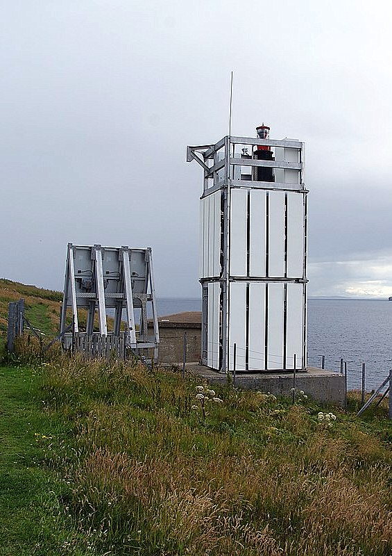
1958 - A3590(Ex) - Straty Point - North
 Engineers(s):
Position (Lat, Lon):
Light Character:
Light period:
Sector:
Peter H. Hyslop
58°35.933' N, 004°01.113' W
Discontinued, 2 March 2012
was Fl. W 20s.
-.-


☰ Click on image to close
1975 - A3102 - Fife Ness - East Coast
 Engineers(s):
Position (Lat, Lon):
Light Character:
Light period:
Sector:
Peter H. Hyslop
56°16.730' N, 002°35.162' W
Iso WR 10s 12m 15-12M
Fl. 5.0s - ec. 5.0s.
W. 143°-197°, R.-217°, W.-023°.


1977 - A3817.50 - Point of Fethaland - Shetland Islands
 Engineers(s):
Position (Lat, Lon):
Light Character:
Light period:
Sector:
?
60°38.049' N, 001°18.676' W
Fl.(3) WR 15s 65m 19-15M
2x Fl. 0.5s - ec. 0.5s., Fl. 0.5s - ec. 12.5s.(?)
-.-

1979 - A3847 - Ve Skerries - Shetland Islands
 Engineers(s):
Position (Lat, Lon):
Light Character:
Light period:
Sector:
R.J. MacKay
60°22.387' N, 001°48.734' W
Fl.(2) W 20s 17m 11M
Fl. 0.7s - ec. 2.0s., Fl. 0.7s - ec. 16.6s.
-.-

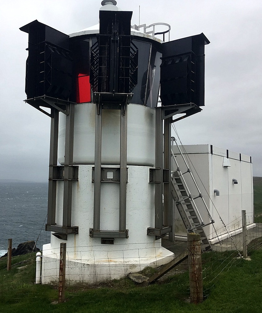
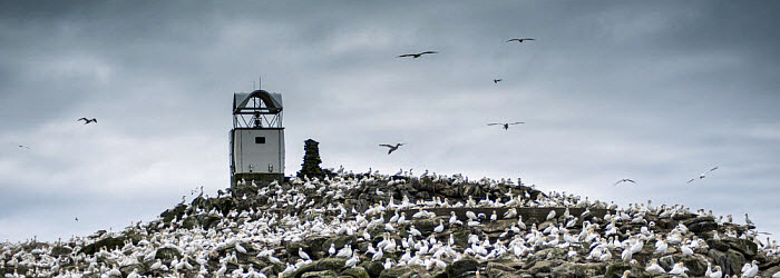
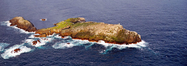
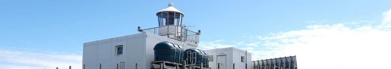
1984 - A3870 - Sula Sgeir - Outer Hebrides
 Engineers(s):
Position (Lat, Lon):
Light Character:
Light period:
Sector:
?
59°05.662' N, 006°09.496' W
Fl W 15s 74m 11M
Fl. 1.0s - ec. 14.0s.
-.-
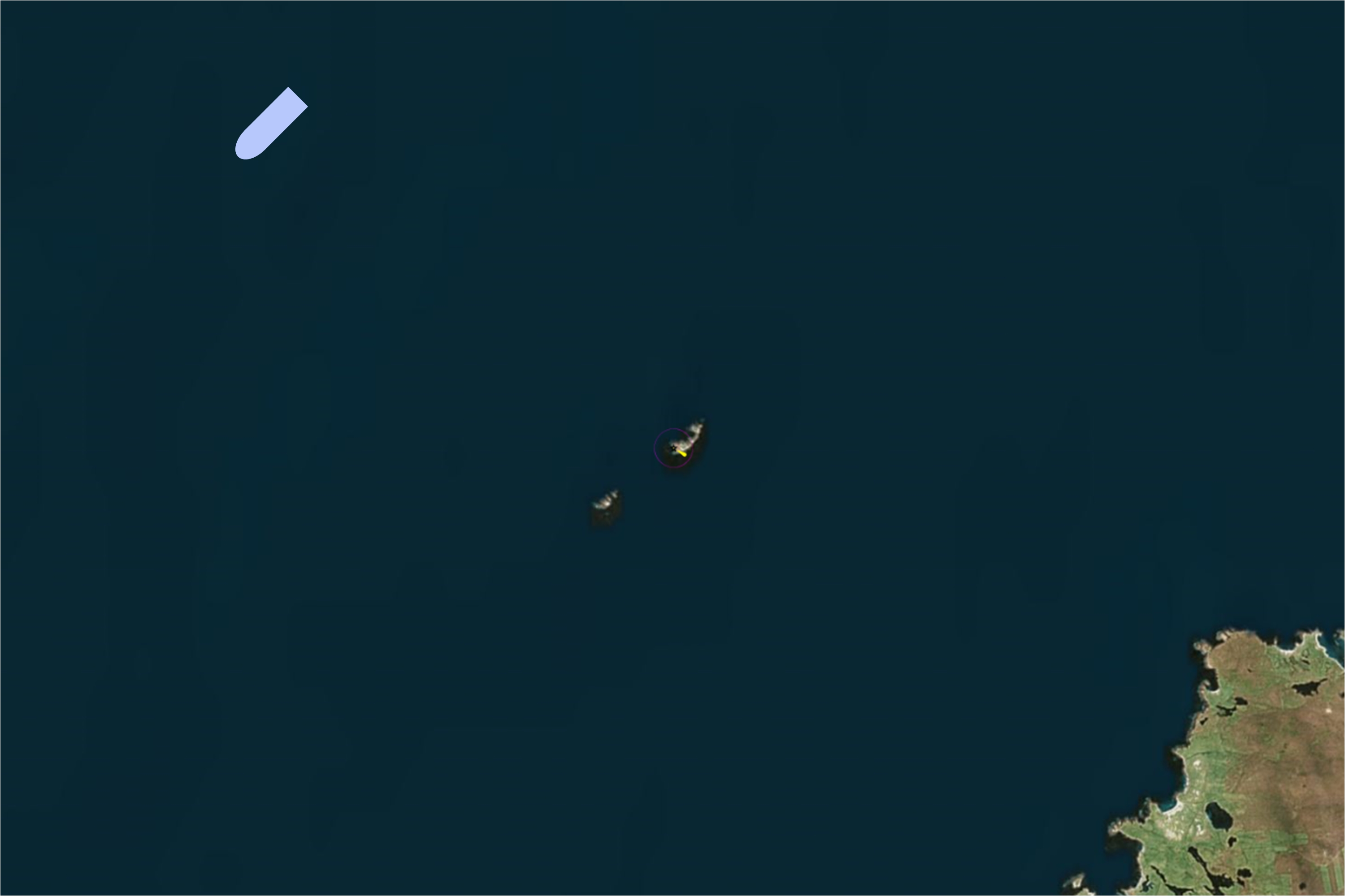
1984 - A3869 - North Rona - Outer Hebrides
 Engineers(s):
Position (Lat, Lon):
Light Character:
Light period:
Sector:
?
59°7.349' N, 005°48.793' W
Fl(3) W 20s 47m 22M
2x Fl. 0.2s - ec. 3.1s, Fl. 0.2s - ec. 13.2s.
-.-
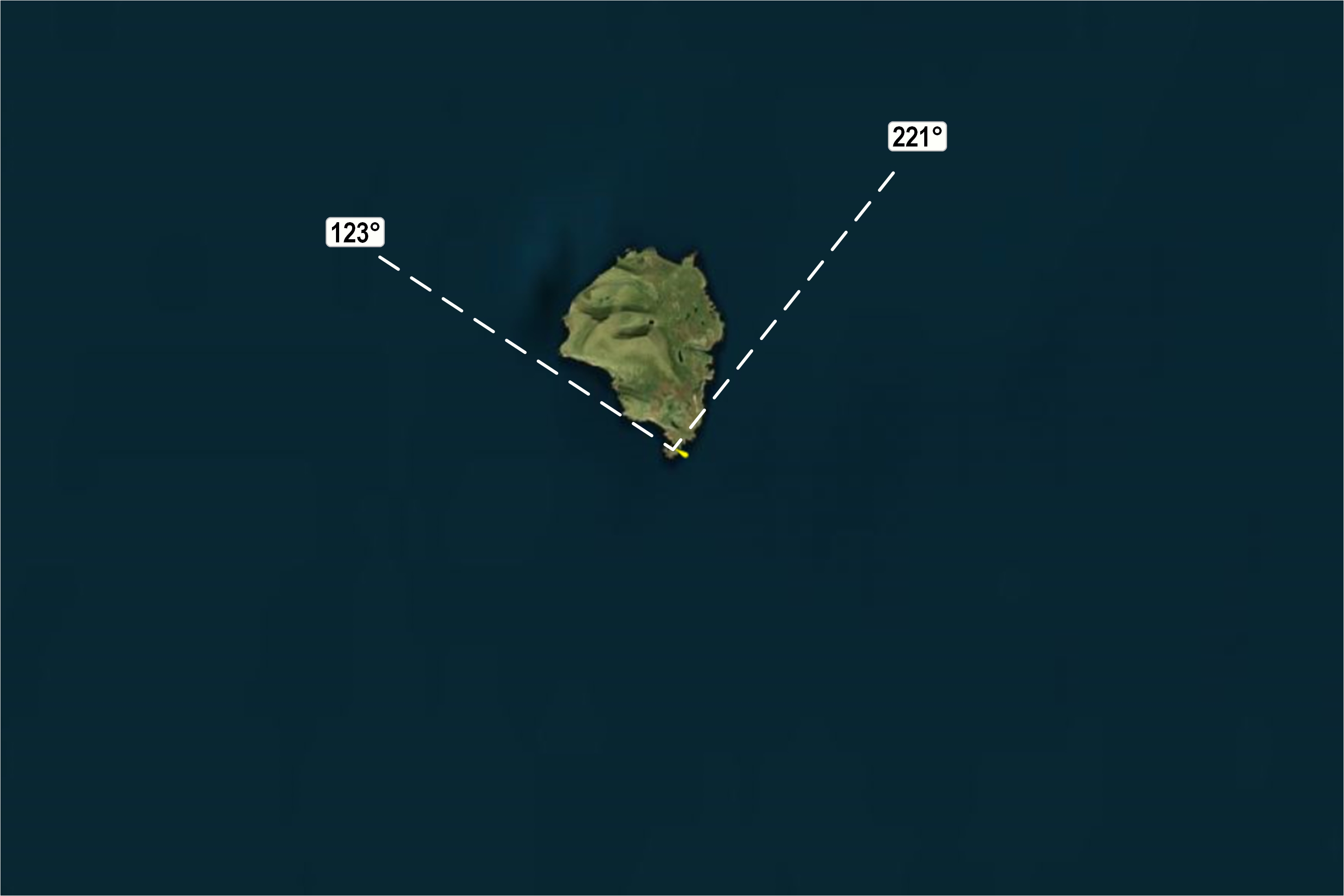
1986 - A3860 - Foula - Shetland Islands
 Engineers(s):
Position (Lat, Lon):
Light Character:
Light period:
Sector:
?
60°06.737 N, 002°03.842' W
Fl(3) W 15s 36m 17M
2x Fl. 0.1s - ec. 2.8s, Fl. 0.1s - ec. 9.1s.
Visible 221°-123°.

1997 - A4020.30 - Haskeir - Outer Hebrides
 Engineers(s):
Position (Lat, Lon):
Light Character:
Light period:
Sector:
?
57°41.950' N, 007°41.330' W
Fl W 20s 44m 23M
Fl. 0.3s - ec. 19.7s.
-.-
| 
 Update: 01-03-2025