
 Update: 01-03-2025


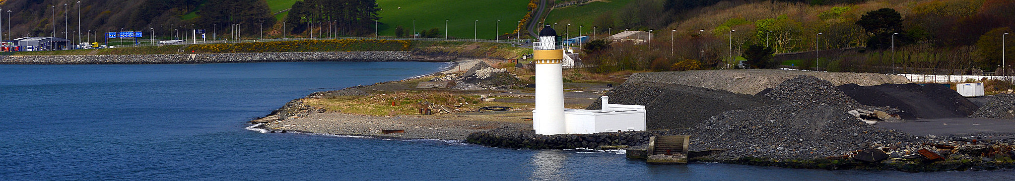
A important natural harbour is Loch Ryan (Gaelic: Loch Rìoghaine), on the north-eastern side of the Rhinns of Galloway at the southwest site of Scotland. The Loch provides calm waters among other things for the ferries operating between Scotland and Northern Ireland (Belfast and Larne). The lighthouse Cairn Point is situated halfway the north-eastern shore of the Loch at the northern end of the village Cairnryan. In the southwest lies the town of Stranraer is the largest town on the shores of Loch Ryan. The ferries passes Corsewall Lighthouse on the northern tip of the peninsula.

The lighthouse was built at Cairn point in 1847. Commissionairs and builders of the lighthouse are not to be obtained from general sources. The lighthouse engineer was Alan Stevenson, 1847. The lighthouse consists of a 4-stage circular lighthouse, tapering down below the parapet; ground floor courtyard. Painted brick and limestone of plastered sandstone.
As much as information of the construction. This lighthouse, unlike other lighthouses, only shows a red light. It is becoming increasingly common that the original light chamber is no longer used to place the lighthouse lamp. This has to do with the ever smaller lamps/devices. Also with this lighthouse, the red lamp (2 x Vega VLB-44/2.5 LED) is on a pole on the balustrade of the lighthouse (see photo left).
The lighthouse engineer was Alan Stevenson, 1847. The lighthouse consists of a 4-stage circular lighthouse, tapering down below the parapet; ground floor courtyard. Painted brick and limestone of plastered sandstone.
On the Northeast side, a wooden gate leads to 2 wooden doors to the 1st floor of the outbuildings with a flat roof; small arched openings in the 2nd and 3rd floors; Corbels are fitted to the 4th floor. The staircase has a round metal handrail. The round lantern has a glazing with a diamond pattern. This has now been darkened to prevent too high a temperature in the lantern. The lighthouse has a domed dome and a ball/finial.
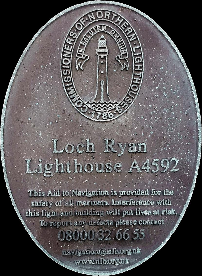
The land was contracted from Sir John Alexander Agnew Wallace Originally a deed was agreed in 1843 for 25 square meters of land, and then an additional deed was agreed in 1847 for a piece of land 30 meters long and 16 meters wide, both for the purpose of a to build a lighthouse. In 1897 another deed was agreed for more land, but these agreements cannot be found in the archives of the NLB.
In 1849 the principal boatlink to Northern Ireland was moved from Portpatrick to Stranraer in Loch Ryan. The reasons for this move from Portpatrick to Loch Ryan were the increasing tonnages of the vessels operating the route to Northern Ireland. These larger ships were more susceptible to severe storms when docked in the exposed harbour of Portpatrick on the Rhins coast. The calmer safer waters of Loch Ryan allowed larger vessels to ply the route as demand increased.
(Portpatrick, on the western side of the Rinns, had long served as a port for a short sea route from Donaghadee in Northern Ireland. Since 1620 the route had been used for importing cattle and horses, and for the transfer of military personnel. Later mail transit for the Post Office mails developed, by 1838 8,000 to 10,000 letters passed through the port daily, brought by coach from both Dumfries and Glasgow.)
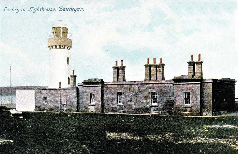
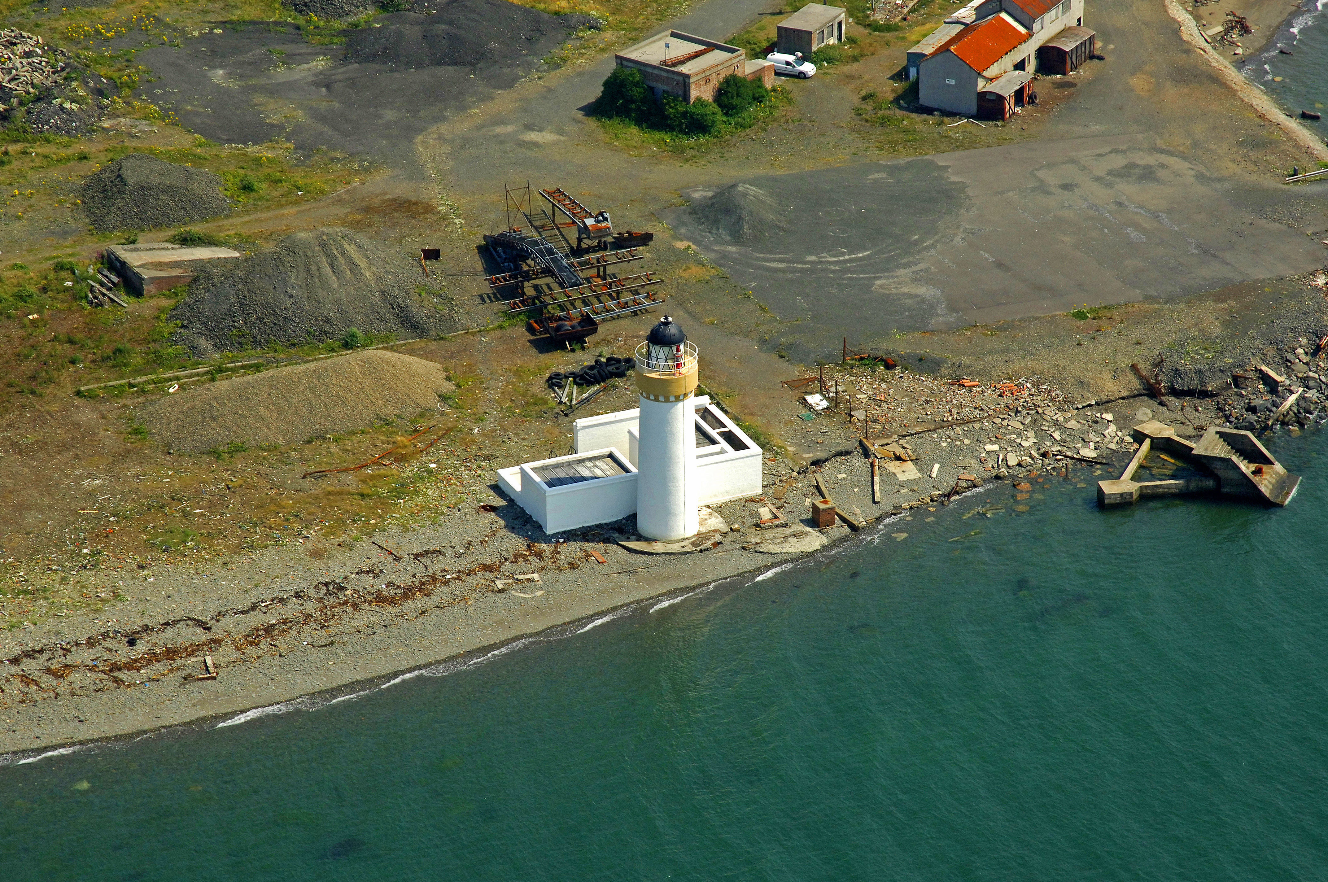
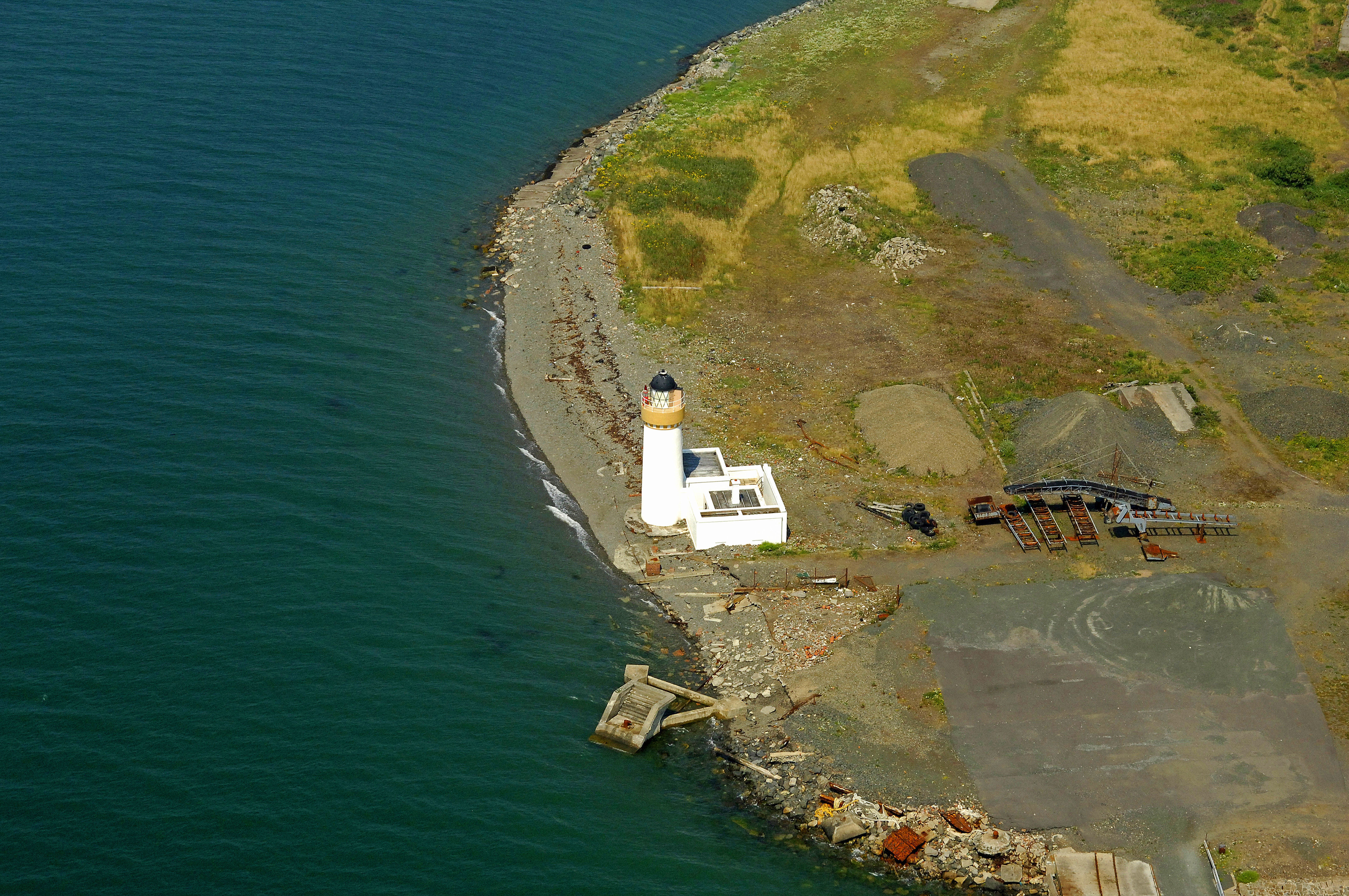
Today the lighthouse stands quite lonely on a site where coarse stone is processed. That was different in the past. The lighthouse also had houses for the Keepers'(see the 1st photo in the right column). These houses were broken up in the 1960s after the automation was completed in 1964. A complete renovation of the building will take place in 2021, including replacement / repair of the masonry stairs in the lighthouse itself and of course a fresh lick of paint.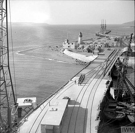
During World War 2, the country needed a ‘spare’ deep water port on the west coast in case the Clyde in Glasgow or the Mersey in Liverpool became unusable due to enemy action. Loch Ryan was ideal, and Number 2 Military Port was built on its northern shore at Cairnryan between 1941 and 1943.
There were three piers, the main ones being the North Deep and South Deep, and a total of 1.5 miles of quayside. There was also a railway network which connected to the main line at Stranraer. Thankfully, the port was never needed for its original purpose as the other ports remained open throughout the war. However Cairnryan was still an important site as one of the main points for American troop ships to dock.
At the end of the war, the German U-boat fleet surrendered and was docked here and at Lishally in Ireland. The winter of 1945/1946 saw these feared submarines, which had sent so many ships to the bottom, towed out into deep water and sunk – this was called Operation Deadllight.
The site remained a military port into the 1960’s, when two of the piers were dismantled. The third was used for shipbreaking, and several Royal Navy vessels fell to the scrap man’s torch here, including the Ark Royal.
Today, the remains of the third pier remain visible – it is very unsafe, so please don’t try to walk along it.