
 Update: 01-03-2025
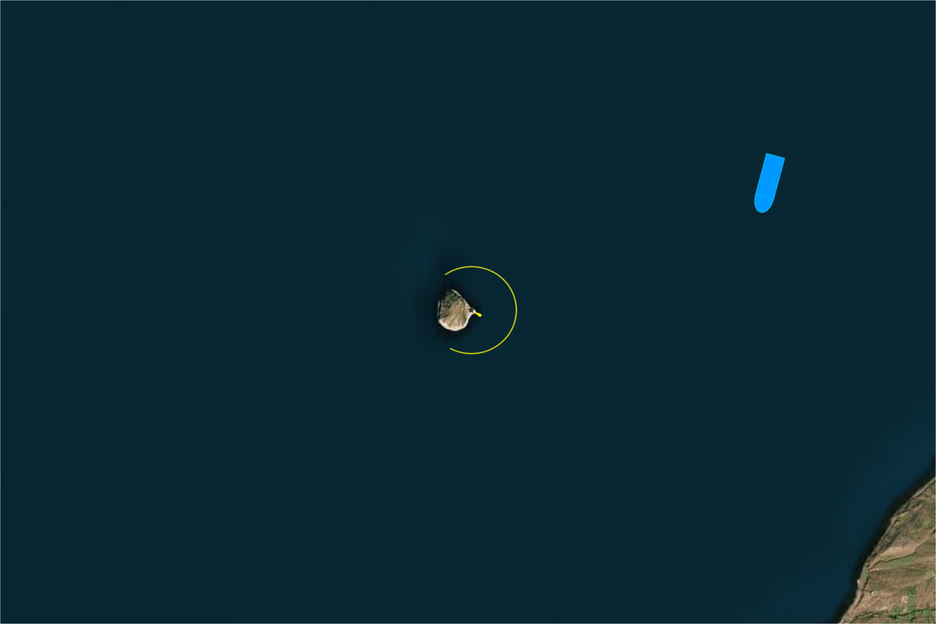


Ailsa Craig (/ˈeɪlsə/; Scottish Gaelic: Creag Ealasaid) is an island of 99 hectares (240 acres) in the outer Firth of Clyde, 16 kilometers from mainland Scotland, upon which blue hone granite was quarried to make curling stones. The now uninhabited island is formed from the volcanic plug of an extinct volcano. It has a conical summit and is very precipitous except on the North East Side where it slopes more gently and is accessible.
The island, colloquially known as "Paddy's milestone", was a haven for Catholics during the Scottish Reformation in the 16th century. Today it is a bird sanctuary, providing a home for huge numbers of gannets and an increasing number of puffins. The island is owned by David Kennedy, the 9th Marquess of Ailsa.
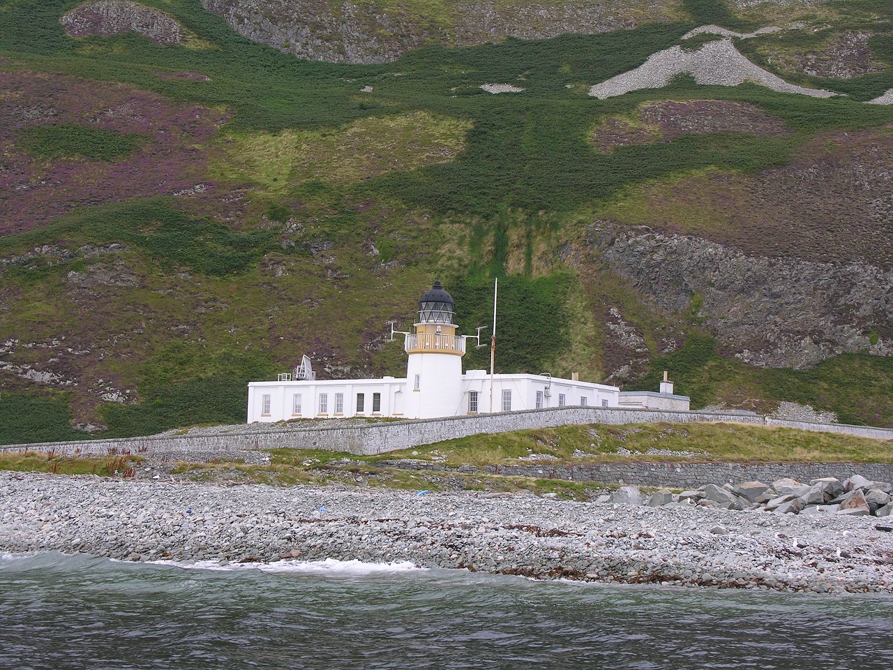
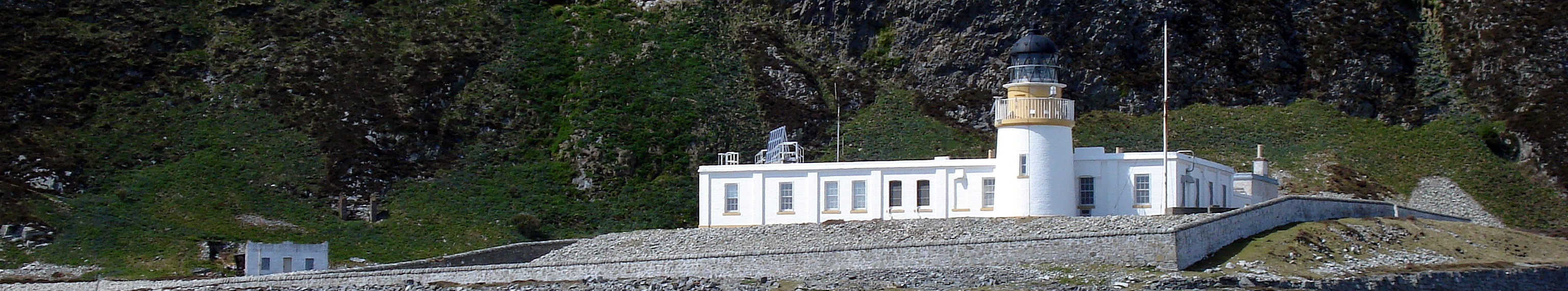
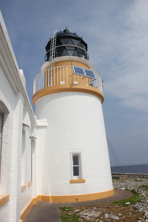
In 1881 the Commissioners of the Northern Lights, predecessor of the Northern Lighthouse Board, received a request from Lloyds of London and the Scottish Shipowners Association to place two fog signals and a lighthouse on the island of Ailsa Craig. The Board of Trade and Trinity House both agreed to the proposal and work began the following year (1882). The Lighthouse was built between 1883 and 1886 by Thomas Stevenson, commissioned by the Northern Lighthouse Board.
The light from the lighthouse was first lit on June 15, 1886. The light was made by an oil burner. This oil burner remained in use until 24 January 1911,when it was converted to incandescent. The lighthouse was automated in 1990 and converted to solar electric power in 2001; the island has been uninhabited since automation in 1990.
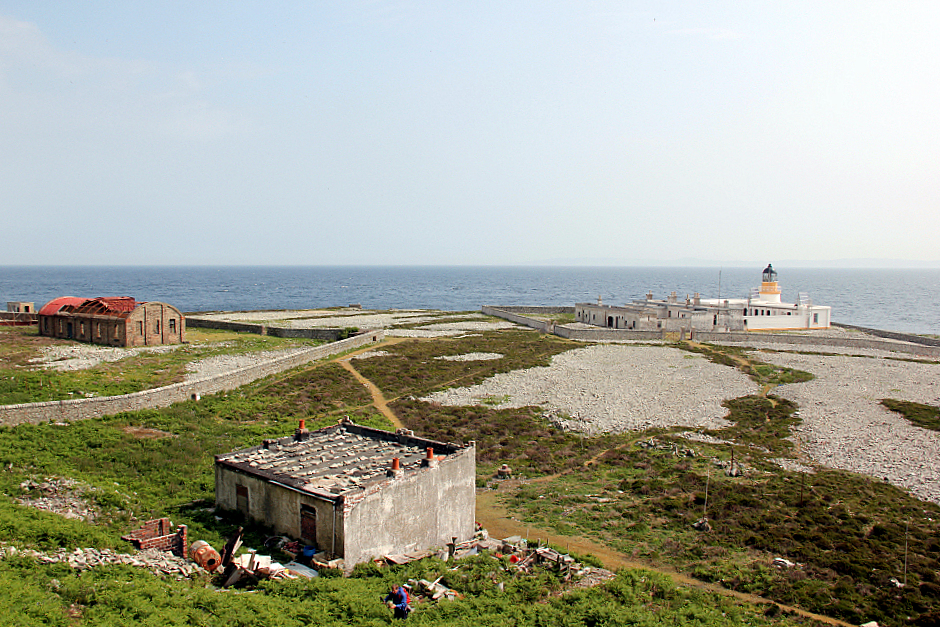
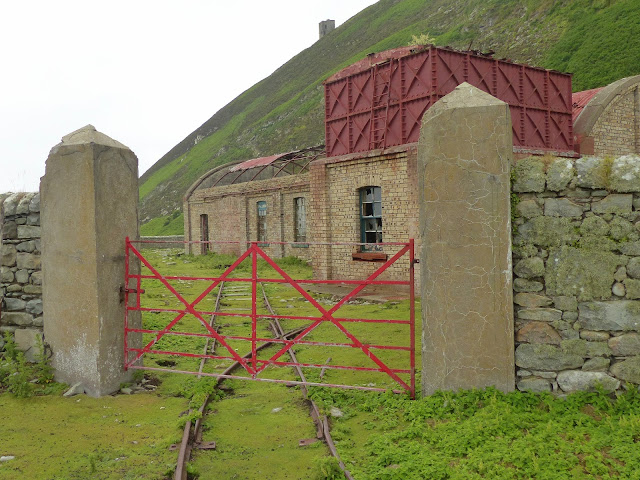
Two substantial foghorns with concrete housings were built in 1866, one at the north end of the island near the Swine Cave reached by the 'The Loups' path and the other at East Trammins on the south end (see the map in the right column).
Both foghorns were powered by compressed air that was piped from the lighthouse where a gas powered compressor was housed until 1911 when oil-powered engines were installed. The foghorns where Siren type and had 3 blasts every 90 seconds
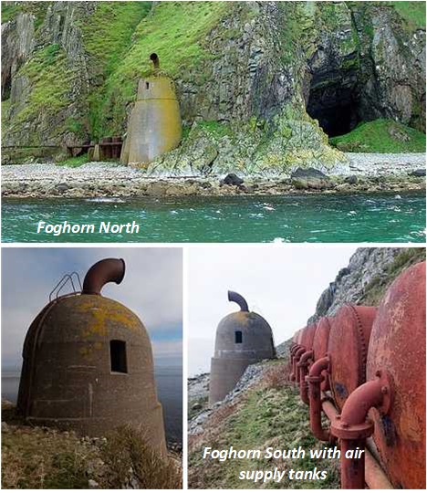
At the same time a new foghorn from the Typhon type was installed. The horn had a character of 3 blasts, each of three seconds duration every 45 seconds. It was sounded from a position close to the South East of the Lighthouse tower and not at either of the previous siren signals sites. This fog signal was discontinued in 1987.
The gasworks are still a prominent feature on the island and the cable-powered tramway was partly built to haul wagons full of coal up to it from the North Port. Two gasholders held the coal gas that powered both the compressed air pump and the lighthouse light, however in 1911 the light was converted to incandescent lighting which was powered by electricity. The gas works became redundant at this time. Lawson records that oil was used to produce the gas for the lighthouse light.
Until wireless telephone communications were established on Ailsa Craig in 1935, the lightkeepers and employees of Ailsa Craig Granites Ltd (see below) used to depend on pigeons for the conveyance of messages. A pigeon house was placed at Girvan Green. The pigeons were provided by the Lighthouse Boatman at that time, who received an annual payment of £4.00.
When a doctor or supplies were required urgently in stormy weather when it was impossible to have messages bringing by pigeon, a system of signals by fire was used. One fire on the castle path showing the Lighthouse to the North indicated "bring doctor for Lighthouse"; two fires on the castle path (one at the same place as the Lighthouse, and the other 20-30 yards above it), meant "bring doctor for Quarry Company". One fire at the north end of the Castle Flat showing the Lighthouse to the South, indicating that provisions were required.

The lighthouse was automated in 1990 and is now remotely monitored from the Northern Lighthouse Board’s offices in Edinburgh. In 2001 as part of the refurbishment and de-gassing programme, Alisa Craig Lighthouse was converted to solar-electric power.
It should be noted that the Northern Lighthouse Board have sold redundant buildings within the lighthouse complex and is not responsible for the maintenance of these building.Ailsa Craig is a small island that is 3.2km in circumference and has been formed by volcanic eruptions stretching tens of millions of years. As the magma cooled quickly it formed a smooth granite that makes up the surface of the island today.
Curling stones are traditionally made of granite, a material found all over the world. However, for the sport of curling, nothing can replace the unique properties of the granite hewn from a quarry on the island of Ailsa Craig off of Scotland’s Ayrshire Coast.
From the mid-nineteenth century the island has been quarried for its rare type of micro-granite with riebeckite (known as "Ailsite"), which is used to make stones for the sport of curling. Ailsa Craig supplies 60–70% of all curling stones of the world. The Island is one of the two sources in the world for all the stones of the curling sport. The other supplier for these stones is the Trefor Granite Quarry in Wales.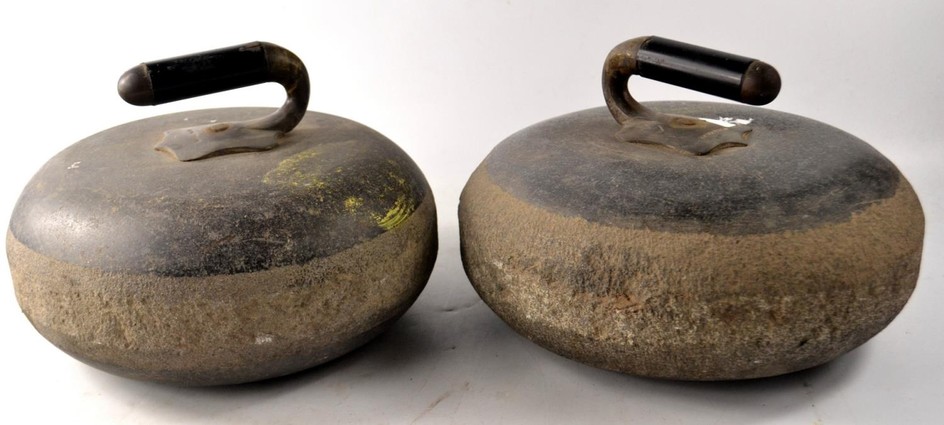
Ailsa Craig produces two types of granite for curling stones, Blue Hone and Ailsa Craig Common Green. Blue Hone. Ailsa Craig Common Green is a lesser quality granite than the Blue Hone. In the past, most curling stones were made from Blue Hone but winning this granite is restricted by environmental restrictions.
Kays of Scotland has been making curling stones since 1851 and has the exclusive rights to the Ailsa Craig granite, granted by the Marquess of Ailsa. After a hiatus of 11 years a "harvest" of Ailsa Craig granite by Kays took place again in 2013, 2,000 tonnes were harvested, sufficient to fill orders until at least 2020. A subsequent harvest was held in the winter of 2020.
the 12 meters high ruins of a 3-storey castle that stands on the eastern side of the island was built in the late 1500s by the Hamilton Family to protect the island from King Philip II of Spain.
The island was used as a prison during the 18th–19th century. The castle has two vaulted storeys and an oven is located in a cellar with evidence of a spiral stairway that once ran to the top of the tower. Three cinquefoils arranged in a 'V' shape are carved on the tower and indicate that the Hamiltons were linked with the structure.
Nowadays, the island is a bird sanctuary featuring a large array of species including gannets, puffins and kittiwakes.