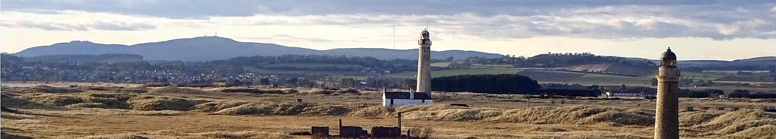
Buddon Ness lighthouse
East Coast

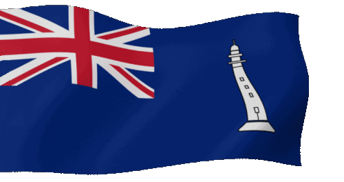
Commissioners' Flag of the NLB
In Salutem Omnium
For the Safety of All
In Salutem Omnium
For the Safety of All


Place of the lighthouses
The village Buddon at the Barry road, lying in the dune area, dates back to around 1850. In 1897 the Earl of Dalhousie sold the area to the War Office for use as a military training area. The area is still used by the various military units, such as the Panmure Battery of the Forfarshire Artillery Brigade, and others.
Light Beacon
The 'Old' Lighthouses
The lighthouse had a constant white light made with 3 small (oil-)lamps, each equipped with reflectors with a diameter of 60 centimeters. The first lighthouse keeper was James Martin. For his work he received a salary of £60 a year and for free use of the house and garden.
In 1813 a second lighthouse

The 'New' Lighthouses
The
The
Both lights are positioned to form a light line into the mouth of the Firth of Tay. Rivers and estuaries are subject to silting and changes in the depth of water as sand or mud move with time, also in the Forth of Tay. This led to a unique operation in 1884 to bring both towers back into alignment.
The Low Light on Buddon Ness was moved to the northeast between 5th May and 4th June 1884. The tower of 14 meter high, built of brick with a weight of 440 tonnes, was 60 meters hauled through the dunes, by a steam engine over greased wooden rails. This engineering feat was remarkable for its time. It is the earliest known instance of a masonry lighthouse being relocated in one piece. The keeper’s house was left remaining in his original position. The cottage of the Low light is now in a dangerous condition, unroofed with some walls collapsing and are fenced off to prevent public access.
After deactivation in 1943, the High Light served for some years as an observation post, and after 1987 it carried a radar scanner as part of Dundee University research project. Site and both towers are closed and still owned by Forth Ports PLC and is now part of the Barry Buddon Training Camp used by the Ministry of Defence
Today the sandbanks and coast of the Forth of Tay are marked only by small beacons and buoys that mark the navigation route.
The video (see right column) shows the two Buddon Ness lighthouses. You can clearly see the rounded end of the cottage by the High Lighthouse, which was the base of the earlier tower. You can also see the remains of the Low Light cottage towards the end of the clip.Buddon Ness
AXXXX![]()
Character: (discont.)

| Engineers | : David Lillie Stevenson (1815-1886) |
| Thomas Stevenson (1818-1887) | |
| Contractor | : --- |
| Constructed | : 1687 - Coal-fired tower |
| 1747 - High - Tower att. to dwelling | |
| 1813 - Low - Tower att. to dwelling | |
| 1866 - Present towers | |
| 1884 - Low tower moved | |
| Init. Costs | : £ --- |
| Function | : Discontinuead |
| Position (Lat, Lon) | : 56°28.136' N, 002°45.014' W |
| Original Optics | : --- |
| Manufacturer | : --- |
| Date First Lit | : --- |
| Current Optics | : None |
| Manufacturer | : --- |
| Date First Lit | : --- |
| Light Character | : --- |
| Light Range | : --- |
| Light Height | : --- |
| Light Intensity | : --- |
| Sector(s) | : --- |
| Tower Height | : One tower of 14 meters |
| Tower Height | : One tower of 30 meters |
| Basic form | : Both: Round towers |
| Material | : Brick |
| Electrified | : Never |
| Automated | : Never |
| Last Keepers | : PLK - --- |
| ALK - --- | |
| ALK - --- | |
| Fog horn | : Never |
| Status | : Discontinued 1943 |
| Current use: Radar Beacon | |
| Authority | : Forth Ports PLC |
| Monument (HES) | : |
| Old house | : Cat.C listed - LB4633 - 15/01/1980 |
| High tower | : Cat.B listed - LB4634 - 11/06/1971 |
| Low tower | : Cat.B listed - LB4635 - 11/06/1971 |
| Remarks | : |
| Adress | : --- |
| --- | |
| Website (local) | : --- |


| References: | |
| Buddon Ness footage | - Youtube Rockwellmedia(c) |
 Update: 01-03-2025