
 Update: 01-03-2025
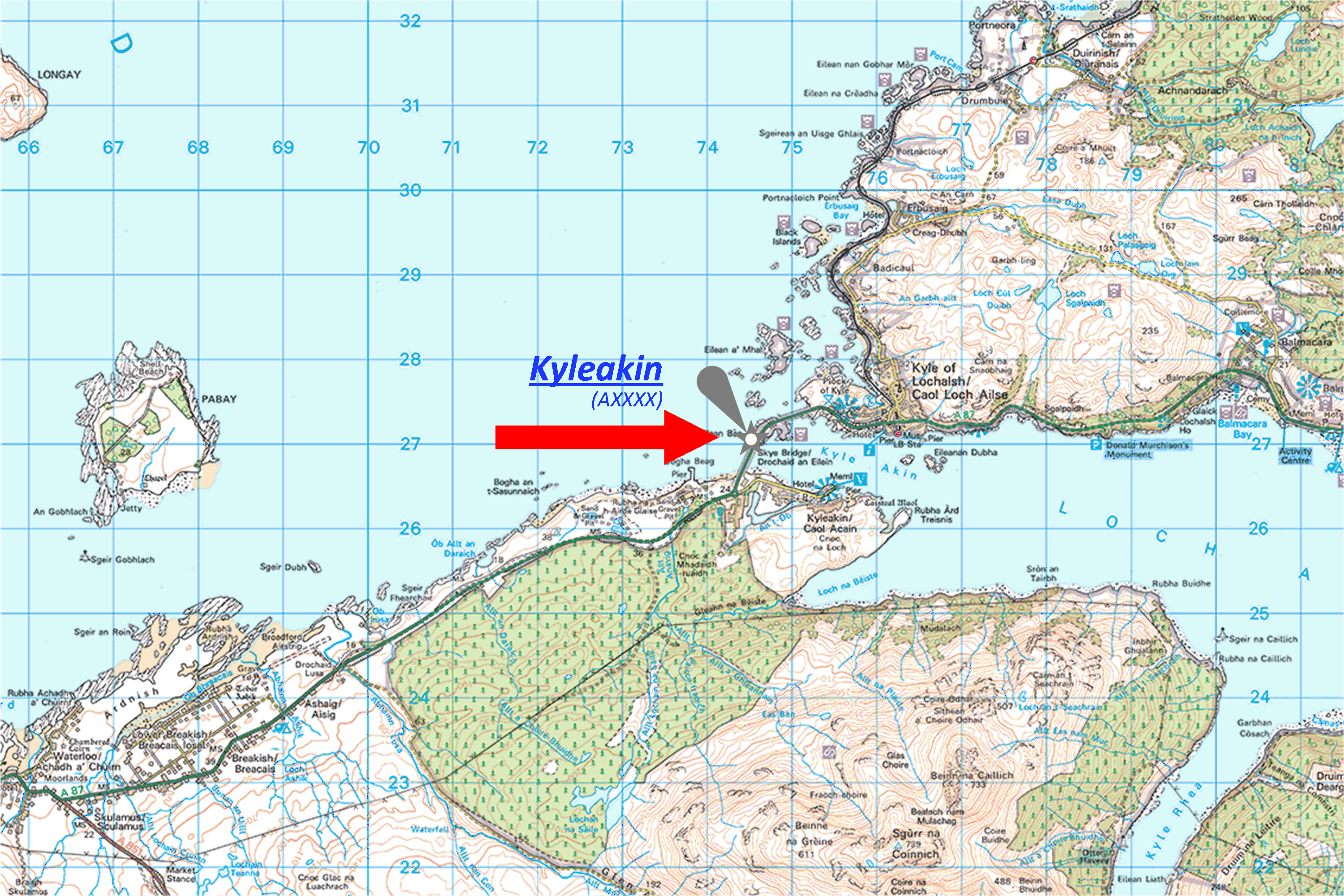

Place of the lighthouse
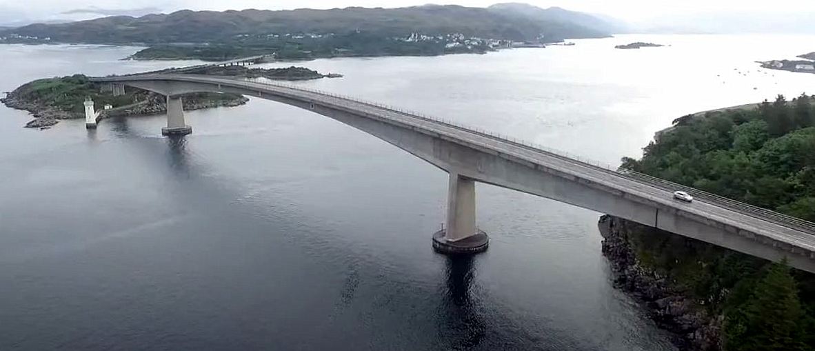
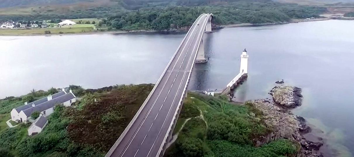
The Kyleakin lighthouse is located on the south-western end of the island Eilean Bàn. This island lies between the mainland of Scotland close to the village of Kyle of Lochalsh and Skye.
Kyle of Lochalsh (from Gaelic Caol Loch Aillse, "street of the foaming loch") is a village in the historic county of Ross-shire on the north west coast of Scotland.
In 1995, a bridge was built at this point between the mainland and Skye. The Skye Bridge uses the island as a stepping-stone as it crosses the mouth of Loch Alsh from the mainland to Skye.
The lighthouse was formerly listed as 'Kyle Lighthouse, Eilean Ban'. This is in 2010 amended to Kyleakin.Building of the Lighthouse
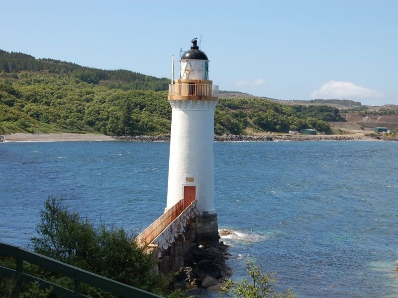
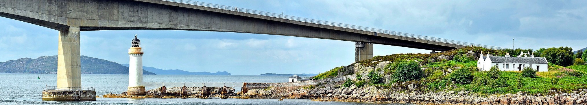
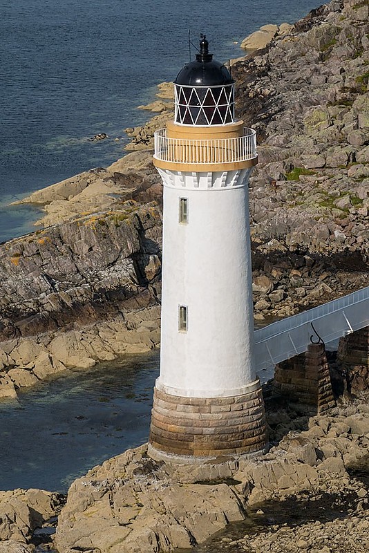
In 1957, under the supervision of David Lillie and Thomas Stevenson, engineers of the Northern Lighthouse Board, a lighthouse was built on Eilean Bàn of 21-meters high. Two single-storey lighthouse keepers' houses were also immediately built, where the lighthouse keepers lived with their families. These houses can be seen on the left in the photo above. In the event of a lighthouse keeper's illness or vacation, an auxiliary lighthouse keeper was available locally in the nearby village of Kyleakan (Isle of Skye).
From the lighthouse keepers houses a path leads to the lighthouse. The lighthouse is connected to the land by a five-span, plate-iron access bridge and concrete causeway.
Warning systems (Fog horn, Radar Beacon, AIS)
When the light was first lit on November 10, 1857, it was fed by sperm whale oil and exhibited a solid central White beam flanked by a Red and a Green sector.
In 1898, the lamp was converted to a paraffin vapor system, for which storage tanks were installed on the island. The paraffin was brought in by boats. Refuelling points were placed on the north and south sides of the island, as greater water depth on those sides allowed larger boats to dock. A large mooring hook for the boats is still in place and can be seen from the path that runs along the north side of the island. A similar facility was also present on the coast at Kyleakin.
When first built the light itself was fuelled by sperm whale oil, and displayed a central white beam flanked by a red and a green beam. It was not until 1898 that the lamp was converted to a paraffin vapour system, with Eilean Bàn holding the storage tanks for the paraffin. These tanks were refuelled by a tripod housing a fuel valve, on the shore. A large mooring hook is still present beyond the tripod and can be seen from the path going along the north side of the island. A similar arrangement is present on the coast facing Kyleakin. The refuelling points were placed on the north and south sides of the island as a greater depth of water on those sides allowed the larger boats to berth. Lighthouse_and_Pier Acetylene gas was a much cleaner fuel and did not require constant pressurisation. In 1960 the lamp was converted to Acetylene gas so the lighthouse no longer needed to be manned all the time. With the departure of the full-time keepers, the island cottages were then put up for sale by the owners, the Northern Lighthouse board. The lighthouse was finally decommissioned in 1993. The channel into Loch Alsh was then marked by the large red and green buoys that can be seen running east and west from the lighthouse. After decommissioning the lighthouse was denoted as a day mark, which means that it remains a landmark that it is used for navigation during the day, and must therefore continue to be kept in good condition.
In 1960 the lamp was converted to Acetylene gas, so that the lighthouse no longer had to be constantly manned. Acetylene gas was a much cleaner fuel and did not require constant pressure.
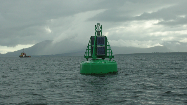
With the departure of the permanent Lighthouse keepers, the houses on the island were sold. The lighthouse itself remained under the management of the Northern Lighthouse Board. The lighthouse was finally decommissioned completely in 1993. The channel to Loch Alsh was then marked by the large red and green buoys running east and west from the lighthouse.Operational status
After the lighthouse ceased to be used, it was sold to the Eilean Bàn Trust. It is now a landmark and is used for navigation (by sight) during the day. Partly because the lighthouse has a protected status (Cat. B listed), it must be kept in good condition.
Additional information
In 1963 the cottages were purchased by Gavin Maxwell, naturalist, conservationist and author of "Ring of Bright Water". However, Gavin Maxwell only moved in after his house in Sandaig was destroyed by fire. He remained on the island until his death in September 1969. Before Maxwell bought the cottages, the living quarters were split in two, but it was later removed, leaving 12.5 meters of space that became known as the Long Room, which is now a museum of Maxwell's life.
In 1996 the houses were dilapidated. The cottages have been restored by the Eilean Ban Trust. And at Kyleakin, the Bright Water Visitor Center was established to provide education and information about the cultural and natural history of the island.
Tours of the lighthouse and cottages are available by booking with the Bright Water Visitor Center.