 Update: 01-03-2025
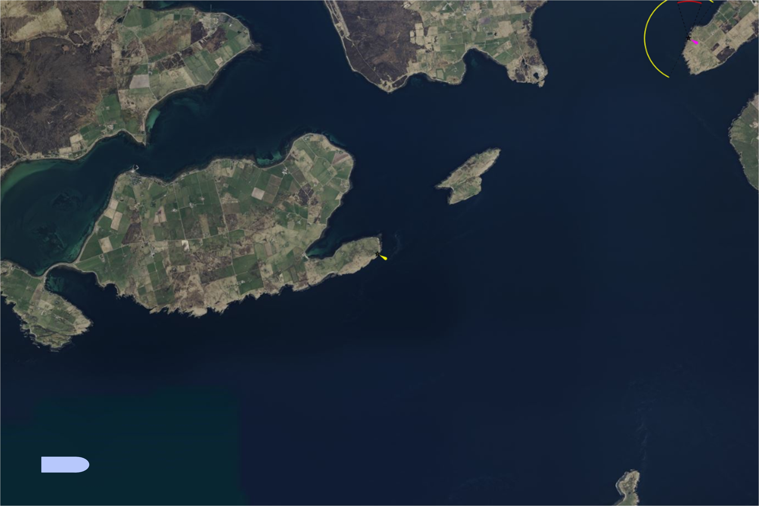


Place of the lighthouse
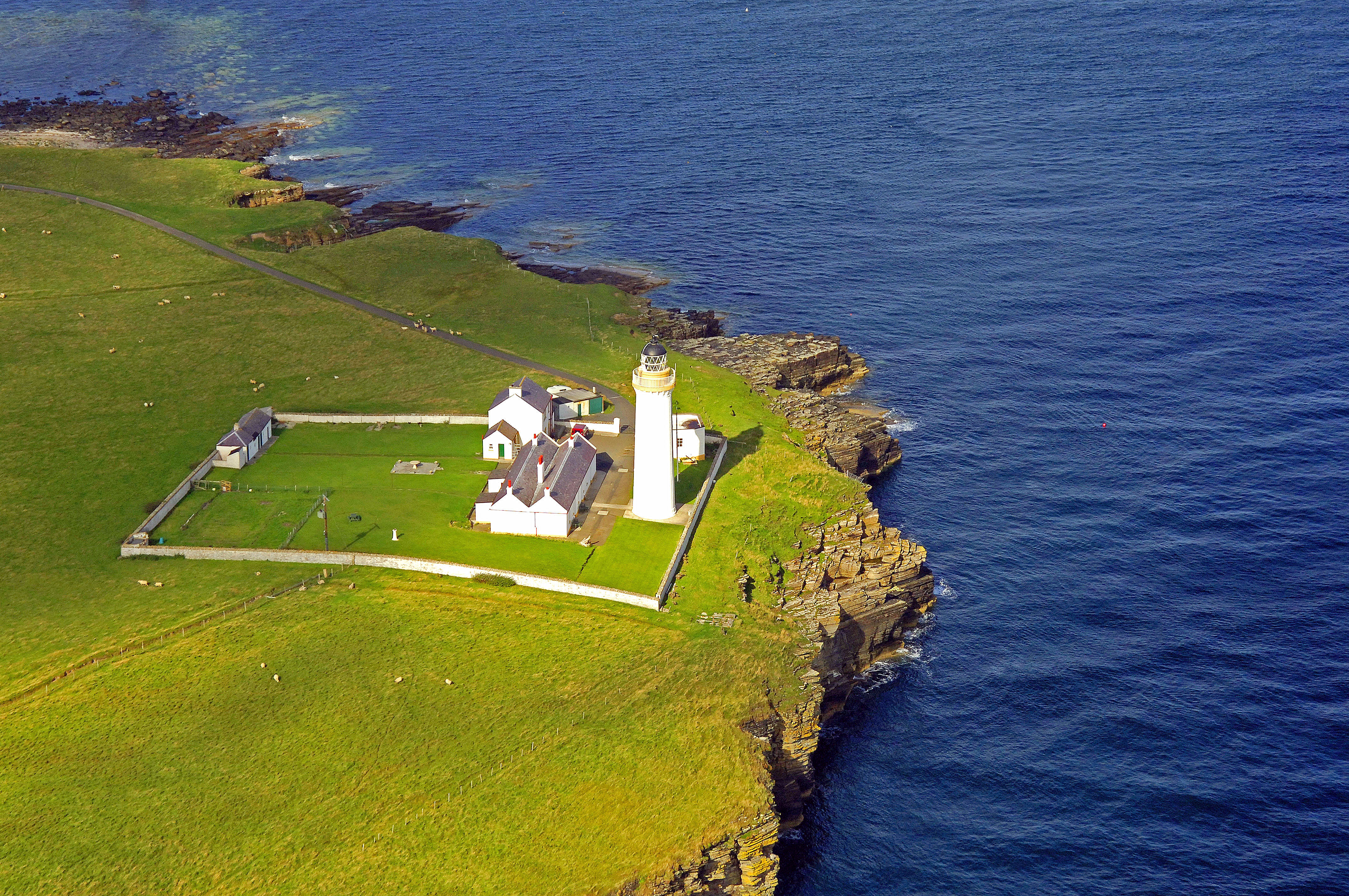
It is situated at the end of Cantick Head, a long peninsula on the south east coast of South Walls that overlooks the Pentland Firth and the Sound of Hoxa, forming the southern entrance to the natural harbor of Scapa Flow. South Walls is connected to the larger island of Hoy by a dam. This gives access to the village of Longhope, Hackness and then the lighthouse further at the south east.
Building of the Lighthouse
The Northern Lighthouse Board indicated in February 1854 that a lighthouse at Cantick Head would be highly desirable. Trinity House and the Board of Trade almost immediately gave legislative approval to the NLB's proposals.
However, lengthy correspondence took place with Trinity House and the Board of Trade regarding the approval of specifications, the nature of the light and the acceptance of building tenders, resulting in construction work not starting until February 1856. The lighthouse is built to mark the southern entrance to Scapa Flow.
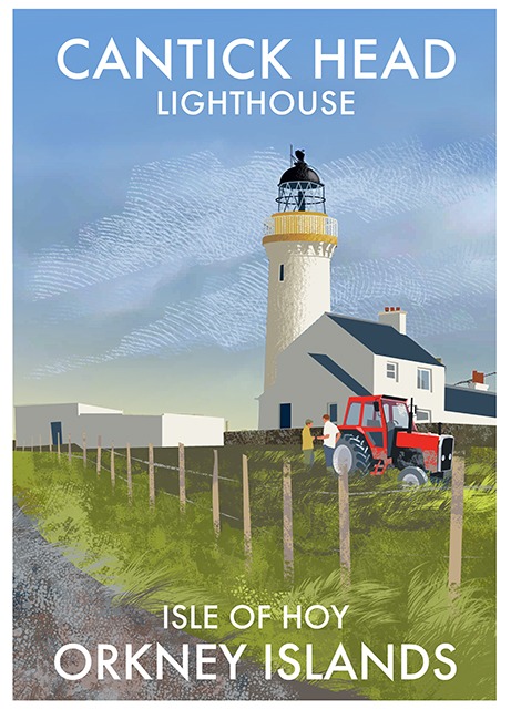
David Lillie and Thomas Stevenson, as the engineers for the NLB, where responsible for the construction of the lighthouse and surrounding buildings. The 22 meter high round stone tower is whitewashed. It supports a single gallery in the well-known NLB color and a lantern with a black cupola on top.
Next to the lighthouse, the necessary buildings have been placed bounded by a walled compound. Such as store/warehouse for supplies such as the paraffin shed, lighthouse keeper's houses and storage space for the garden and/or livestock. The characteristic sundial, which stood at all lighthouses of the NLB, is also still present.
The two single-storey stone lighthouse keepers' houses deviate from the construction of the earlier houses in which the Neoclassical style was applied. Which is a characteristic of the changing era.Warning systems (Light, Fog horn, Radar Beacon)
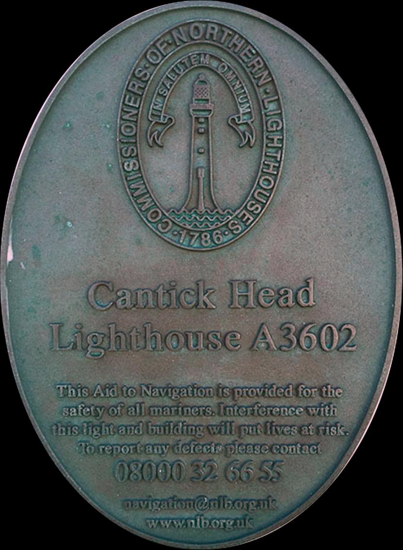
The light was first exhibited on the night of 15 July 1858. It has been powered by candle, paraffin. Cantick Head Lighthouse is now automatic and continues in operation today. Now the lighthouse is provided with sealed beam light PRB 46. The original lens is housed at Lyness Museum.
A fog horn was established in October 1913 and discontinued in 1987. The engineer's shed housed the three former Kelvin diesel engine, which generated the air for the foghorn. The foghorn was in use from 1913 to 1987.
Operational status
The light was automated in 1991 and is now controlled remotely from the Northern Lighthouse Board's offices in Edinburgh. The lighthouse keepers' houses were sold and converted into holiday homes. DE NLB no longer has any responsibility for the maintenance of these buildings.
Additional Imformation
The Hackness Coastal Battery was built in 1813 when the United Kingdom was at war with Napoleonic France and with the United States of America. The battery was to protect Longhope Sound, which served as an anchorage for British and Scandinavian merchant ships. In 1814 the battery was extended with two Martello towers: one at Crockness, on the west side of Longhope Sound, and one at Hackness, on the east side of Longhope Sound. (A Martello tower is a type of defensive fortress, which was built in many places in the British Empire in the nineteenth century.)


The gate of the complex is located on the southeast side and is flanked by the officers' quarters on the northeast side and by the guard house on the southwest side. On the southwest side of the complex, as far from the guns as possible, was the powder magazine, which was built below ground level and surrounded by an earthen embankment. The latrines are located northwest of the powder magazine. Northeast of the powder magazine is a block containing the kitchen, laundry and storage areas. Northeast of this block is an L-shaped barracks housing the gunners. There are narrow, vertical windows on all sides of the barracks, which can serve as embrasures.
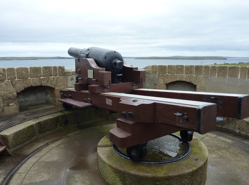
The battery was modified in 1866, so that instead of eight 24-pounders, four 68-pounders could be placed. These guns were behind a parapet that has the shape of a crescent. The guns together covered a field of 120 degrees. At either end of this parapet was a small gun store for rifles on the inner side. In the center, also on the inside, was a small powder magazine, the so-called forward magazine.
During the First World War, the Battery barracks were used to house anti-aircraft gunners. Hackness Tower was used as a lookout. In 1922 the Battery and tower were sold to the tenant of the time, William Cload, who used the complex as a farm. In 1995 Historic Scotland bought the complex from his grandson.
The Hackness Martello Tower is built almost entirely of red sandstone. The Martello Tower has an elliptical plan, with the wall on the sea side being twice as thick as the wall on the land side to better withstand naval bombardments. The wall is 4.25 meters thick at its thickest point. The tower has only one entrance, which is four meters above ground level on the landward side, accessible only by a ladder. The entrance leads to a room with a diameter of 7.6 meters that serves as a barrack for nine gunners, with a shielded room for the officer.From the room that served as a barrack, stairs have been made in the wall going down and up. The stairs lead down to the ground floor, where the storage room and powder magazine are located. The gunpowder room is equipped with a vault so that the turret is protected as much as possible in the event of an explosion of the gunpowder. The powder magazine was accessible through the shifting room, a room where people changed into clothes that had no metal parts, as metal could cause sparks. The powder magazine had a light closet where a lamp was placed behind a glass window to illuminate the powder magazine without there having to be a fire in the magazine itself. Below the storage areas is a room in which rainwater from the top floor was collected after filtering. This water could be pumped up to the barracks with a hand pump and served as drinking water.
From the barracks, the stairs lead up to the gun platform on top of the tower. Here is a round iron track resting on granite stones. On the track, a cannon can rotate 360 degrees. When built, a 24-pounder was mounted on the tower; in 1866 it was replaced by a 68-pounder. Now there is a 64-pounder on a modern reproduction of the original gun carriage.History of the Longhope lifeboat disaster in 1969
In the cemetery at Kirk Hope on South Walls in Orkney is the memorial to the eight-man crew of the Longhope lifeboat. The entire crew lost their lives in 1969 in the Pentland Firth leaving seven widows and ten orphans behind. Of these eight crews, the coxswain and the motor mechanic had their sons aboard. South Walls has never recovered from this blow and no one wants to speak about it. In fact, there is very little to be said; because no one knows exactly what happened. See also the website of the RLNI and Longhope Lifeboat Museum.


The Longhope lifeboat was a 48ft Solent type, built of steel and just under 28 tons. She had a maximum speed of 9.2 knots and an endurance at cruising speed of 46 hours. She was named TGB, after an anonymous donor.
The lifeboat was launched at 8pm on 17 March 1969, after a Mayday (SOS) call by the captain of the 2,300-ton Liberian steamer, "Irene" which was drifting out of control through a South-east gale, force 9. This storm had been blowing for three days and it just kept blowing. Visibility was poor due to, among other things, snow storms.
Although the Captain of the "Irene" gave her position as 18 miles off South Ronaldsay she was actually only three miles off the east Coast of mainland Scotland. The Coastguard Rescue Headquarters, which covers the Orkney archipelago, had already alerted to carry out a rescue mission from the cliffs of the shore, as soon as the opportunity presented itself.
At the same time as the TGB was launched, the Kirkwall lifeboat, the "Grace Paterson Ritchie" was put to sea. A 70ft Clyde class boat weighing nearly 87 tons with a maximum speed of 11 knots.
At 8.40pm the TGB gave her position by VHF-radio as 3 miles South East of Cantick Head Lighthouse on South Walls, which placed her five miles from her launching place. With high water at Pentland Skerries just after mid-night the flood was now near its full strength, and it was a spring tide. It was the way into death's dark vale, if ever there was one. "It was a terrible, terrible night. You could see nothing but a white haze, no sea," George Manson said, postman at Duncansby and also auxiliary coastguard. As mentioned, in right column, see also the website of the RLNI about this disaster.
Forty minutes later, at 9.30 pm, the TGB was sighted by the Principal Lightkeepers of the Pentland Skerries in line with Lother Rock, about four miles south-east of her previously reported position.
The TGB was now in almost deadly situation, with the flood running like a millrace to the south-east out of the Firth the east side of South Ronaldsay, both of them opposed by a south-east gale.
The last reporting signal for the TGB was now picked up by Coastguard headquarters, Wick, and a few minutes later she was seen for the last time, again from Pentland Skerries, in Brough Sound, between the Lighthouse and Brough Ness, identifying her stern light and apparently on a north-easterly course.
It proved impossible even for the 70ft "Grace Paterson Ritchie" to approach the "Irene" at 11.05pm. Kirkwall Coastguard Headquarters asked her coxswain to search the coast of South Ronaldsay south-wards for the TGB. At 11.15pm the Kirkwall boat fired a parachute flare; but there was no answering signal.
Nothing more was seen of the Longhope boat until the following afternoon when the Thurso lifeboat found the TGB floating upside down, four miles south-west of Torness some fifteen sea miles away at the Western entrance to the Firth.
When the TGB was investigated in Scrabster Harbour she was found to have suffered serious hull damage. Seven bodies were found on board, six in the cabin, the seventh, that of the coxswain, at the wheel with a broken neck. The eighth member of the crew, the motor mechanic, was never found.
The findings of the inquiry held by the RNLI were that the TGB had been overwhelmed by very high seas and maelstrom conditions while proceeding eastwards between South Ronaldsay and Pentland Skerries.
The 17 crew of the "Irene" were rescued from the shore, where she had driven in near Grim Ness at the north-eastern end of South Ronaldsay, by the two coastguard emergency companies in the biggest breeches buoy operation ever effected in Orkney.